Friday, April 29, 2011

Historic Tornado Outbreak for All the Wrong Reasons

As we feared would be the case, the tornado outbreak of this past Wednesday has now become historic.  As of this writing, 318 people are currently reported as dead as a result of the outbreak.


By crossing the 315 mark, this event has now become more deadly than the "Super Outbreak" of April, 1974.  The only bit of good news here is that an "all time" record for tornado deaths in a single day has not been touched.  It remains at 747, from the events way back in March 18, 1925.


Many have been questioning whether or not this recent event would surpass the 1974 Super Outbreak in other ways as well, particularly with respect to tornado count and/or "path miles" (which refers to the total path length, in miles, carved out by the tornadoes during a given event).


Map of Tornadoes Associated with the 1974 "Superoutbreak"

The "Super Outbreak" of '74 (see tornado track map above) is called "Super" for many reasons:

-315 people killed
-148 individual tornadoes across 13 states
-total damage path length of 2,600 miles 
-over 900 square miles of property damaged "extensively"


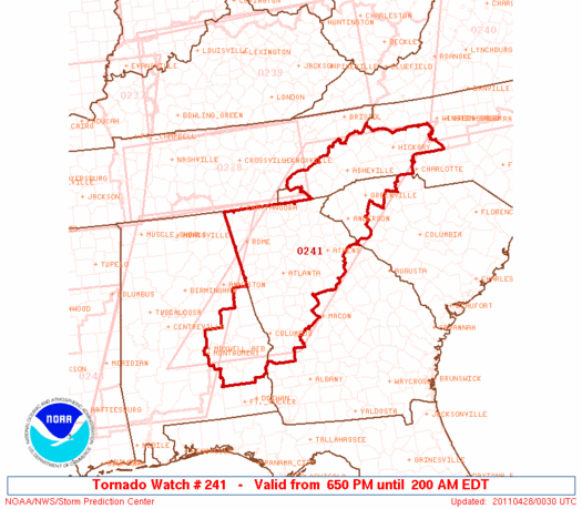
So far, the outbreak of this past Wednesday, 4-27-11 (see preliminary tornado track map below), has surpassed the 1974 "Super Outbreak" in only one (but certainly the most important / tragic) category:  the death toll.


Storm surveys and damage assessments are still underway.  It remains to be seen if any of the other categories that made the 1974 outbreak "Super", will be surpassed by the events of this past week.  Stay tuned for updates...

Thursday, April 28, 2011

Severe Weather Threat Continues Along Eastern Seaboard Today


The historic severe weather outbreak of the past 2 days continues to roll Eastward today, with the Eastern Seaboard being affected as of this writing.  The above image shows the latest Tornado (red) and Severe Thunderstorm (blue) Watches that are in effect.

Below is the severe weather outlook for today from the SPC.  If you live in the yellow shaded areas, please remain alert and seek safe shelter in the event that severe weather threatens your area:


Large hail and damaging winds will be the greatest severe weather threats today, however isolated tornadoes are also possible, particularly within the yellow and brown shaded areas on the image below:


Preliminary Recap of Wednesday's Tornado Outbreak


The above image shows preliminary storm reports received by the SPC for Wednesday.  So far, 162 tornadoes have been reported.  Keep in mind, this number will change as damage surveys are completed (i.e., more than one spotter report of the same tornado could have been counted, etc.).  

Regardless of the final actual count, needless to say it was an extremely active day with several long track, damaging tornadoes.  Total severe weather reports (tornadoes, wind damage & hail) tally up to 648 so far.

The image below shows a more close-up view of Alabama, with tornado reports indicated by the red icons:


Again, this is a preliminary map, but you can see several "swaths" of what appear to be long track tornadoes.  I will be taking a closer look at the data over the coming few days (as well as reviewing storm survey reports) and will make a more detailed analysis on a storm-by-storm basis later on.

One supercell thunderstorm in particular appears to have tracked from near Philadelphia, MS across the entire state of Alabama (striking Tuscaloosa and Birmingham) and into northwest Georgia before ending somewhere around the Tennessee / North Carolina border.  This track is over 350 miles long, and the storm appears to have had a tornado on the ground with it for the majority of the time.

The loss of life across the South yesterday was tragic, currently reported as over 170 (131 of which are currently reported in Alabama alone).  Over 600 people are reported as injured.  Please keep this entire region in your thoughts & prayers as the recovery process will be a long one.  The devastation is incredible.  I will post just a few damage photos below, there will be much more to come in more detailed posts later on:


You can also take a look at this post (which deals specifically with the tornado and damage in Tuscaloosa) for some very impressive videos of and other images of both the tornado and damage.

Check back to the main blog page frequently over the next few days for more detailed summaries on individual storms as more data comes in.  I'll also post detailed radar imagery for each event as well.

Wednesday, April 27, 2011

Severe Weather Rolls On...

Tornado (red) and Severe Thunderstorm (blue) Watches are currently in effect for the regions indicated on the map below:


The latest composite radar image shows intense thunderstorms continuing to advance toward the Northeast or East/Northeast across the Southeastern third of the country:


The threat of severe weather, including tornadoes, will continue to progress into areas East of the current location of the thunderstorms overnight.

Residents across the Southeast and East-Central U.S. should keep a weather alert radio on overnight, or arrange for some other method of obtaining severe weather warnings.  Tornadic storms are especially dangerous at night.  Please don't let your guard down if you are in these areas.

Severe Weather Update - Atlanta Area


The above image was recently taken from the Atlanta area doppler radar.  A very intense, supercell thunderstorm is moving Northeast at 45 mph toward the southern suburbs of Atlanta.

This storm is showing signs of rotation on radar.   Large hail and damaging winds are also possible with this storm.

On its present track, this storm will affect the southern suburbs of Atlanta during the next hour.  Residents along and ahead of this storm should seek shelter as threatening weather approaches.

Tornadic thunderstorms are especially dangerous at night.  Please keep alert if threatening weather approaches your area.


Severe Weather Update

Intense thunderstorms continue across a large part of the Eastern third of the U.S. at this time:


Below is a close-up of the most intense activity across the Southeast:


Tornado Watches continue across these areas:


If you live in any of the above watch areas, or in any of the purple or red outlined areas on the latest severe weather outlook map below, please stay very alert overnight and be prepared to seek shelter if threatening weather approaches your area:


Atlanta Metro...Prepare for Severe Weather


Intense thunderstorms producing large hail, damaging winds and tornadoes are rapidly moving toward the Georgia border with northeast Alabama.  Atlanta is noted by the white circle with the red arrow toward the center of the image.

If the present storm track continues, this activity will move into the Atlanta area within 90 to 120 minutes.  Residents across northwest Georgia should remain very alert and be prepared to seek immediate shelter as threatening weather approaches.

Severe Weather Update

The composite radar image below shows widespread severe thunderstorms continuing across much of the Southeast.  The white circles indicate the storms that either have a tornado on the ground, or have a strong radar signature indicating that a tornado is possible at any time:


Probably the most dangerous looking supercell storm on radar at the moment is along the Alabama/Georgia border, North/Northeast of Piedmont, AL:  


This very dangerous storm will cross the border into Georgia shortly, and is heading in the direction of Cave Spring, Cedartown and Six Mile.  If you live in or near these areas, seek immediate shelter.

The SPC has just issued a "PDS" Tornado Watch for northwest Georgia, southeast Alabama, extreme northwest South Carolina and southwest North Carolina.  This watch includes the Atlanta, Greenville, Asheville and Montgomery areas:


...and is in effect until 2am EDT.  "PDS" refers to the rarely used wording "This is a Particularly Dangerous Situation..." which is indeed the case this evening.

Other watches that remain in effect at this time are shown on the image below:


If you live in these areas, or to the immediate East of these areas, please remain alert and be prepared to seek shelter if threatening weather approaches your area.


Severe Weather Update - Alabama


Intense, supercell thunderstorms continue across the northern half of Alabama, as per the snapshot of the Birmingham radar above.

One of the most intense storms at the moment is  South of Birmingham, between Centreville and West Blocton.  This dangerous storm (debris ball indicated by white circles on images below) is moving Northeast at 55 mph:


Residents of Eoline, Six Mile, Marvel, Montevallo, American Village and nearby areas should seek immediate shelter.

Intense Tornadic Supercell Moving Into Birmingham, AL Area

***Update 6:22 PM CDT:

The storm seems to be undergoing some sort of transition or reorganization, with the tornadic signatures having weakened significantly during the past few minutes.  Still, if you are in the path of this storm, seek shelter as the tornado could reform at any time:


***Update 6:10 PM CDT:

Debris ball with damaging tornado noted by white circle in images below:


Cities of Center Point, Pinson, Chalkville and Clay are next in the path of this dangerous tornado at this time...moving Northeast at 60 mph.

***Update 6:00 PM CDT:

Based on the present track of the storm, the Western and Northern sides of Birmingham are at greatest risk of this damaging tornado.  The cities of Tarrant City and Fultondale should also be in shelter:


***Update 5:51 PM CDT:

Residents of Birmingham, a very dangerous tornado situation is moving rapidly your direction.

This intense storm is moving Northeast at 55 mph.  Seek shelter now!!!

***Update 5:44 PM CDT:

The debris ball and other circulation signatures on radar are even stronger now than when originally posted just a moment ago:


The warning provided in the original post still applies...

----------------Original post below:

A massive supercell with likely tornado is moving Northeast to the Southwest of Birmingham, Alabama at present.  Below is a recent reflectivity (rain, hail, etc.) radar image of the storm:


...and below is the velocity (wind speed & direction) image of the same storm:


This dangerous storm is moving toward the cities of Birmingham, Hueyton, Bessemer, North James, Hoover, and Homewood.  Seek immediate shelter in and near these areas!  The white encircled portion of the radar images indicates what appears to be a "debris ball" meaning that a tornado is on the ground and causing damage, sucking debris up into the storm which is being reflected back to the radar.

Severe Weather Update: Alabama


As you can see by an image from the Birmingham, AL radar taken a moment ago, severe (many of which are tornadic) thunderstorms are overspreading the Northwestern half of Alabama.

Tornado warnings are in effect for the counties within the purple polygons below:


Next stop will be Georgia.  Folks in northwest Georgia need to be on the alert and prepare for widespread, possibly significant, severe weather this evening.


Severe Weather Update


With so much going on at one time, I figured I'd post the above composite radar of the southeast U.S.  Every storm with strong rotation (indicating an ongoing or possible tornado) is circled on the image below:


Tornado watches continue for all areas indicated in red below.  The blue area is a severe thunderstorm watch:

Additional watches are likely further Eastward throughout the afternoon & evening.  Residents, particularly those within the red and pink areas on the image below, should remain alert and be prepared to take severe weather precautions as this outbreak progresses:


Severe Weather Update - Mississippi


Just about every thunderstorm you see on the above image from the Jackson, MS radar is rotating.  In particular, the storms to the immediate Southwest of Jackson, to the Northeast of Philadelphia and between Walthall and Calhoun City are showing strong signs of rotation.

Thunderstorms in northern Mississippi are moving Northeast to East / Northeast at 50-60 mph.  Storms in southern Mississippi are moving East at about 50 mph.

The potentially tornadic portion of the storm Southwest of Jackson will pass south of the city, affecting Crystal Springs, Terry, Braxton and perhaps Florence.  There are other storms forming West of Jackson, and those will have to be monitored closely as they intensify and move directly toward the city over the next hour.


Severe Weather Update - Eastern Tennessee


The above image was taken from the Knoxville, TN area radar just a moment ago.  You can see a line of thunderstorms, some strong to severe, moving Eastward into the Eastern portions of Tennessee.

Severe thunderstorm warnings are noted in red, tornado warnings are noted by the purple polygons (near the Georgia border).

This activity is moving into an area that is less unstable than further South and West, and according to a recent statement by the SPC in Norman, OK, they are not certain that a new severe weather watch will be issued ahead of the line over eastern Tennessee at this time.

None-the-less, heavy downpours of rain, some hail and gusty winds can be expected with central and northern portions of this line as it continues Eastward this afternoon & early evening.  Further South along the line nearer to the Georgia / Alabama borders, a stronger threat of severe weather, including an isolated tornado, exists as the air is more unstable in this region.

This won't be the last round of thunderstorm activity for eastern Tennessee.  Activity also continues further West over Western and Middle Tennessee.  We'll have to watch this activity as it progresses Eastward later this evening.

Latest "PDS" Tornado Watch Issued for Alabama...


The above watch is valid until 10pm CDT.  Very large hail and long track, damaging tornadoes are possible in and close to the watch area.  A similar Tornado Watch is in effect to the immediate West over much of Mississippi until 7pm CDT.

"PDS" stands for "Particularly Dangerous Situation".  Only a relatively small percentage of all Tornado Watches issued by the SPC contain such language.  It is meant to alert residents of the extraordinary danger associated with this particular situation.

If you live in Missississippi, Alabama, or adjacent portions of Tennessee, please stay alert this afternoon & evening.

Residents of Georgia:  this dangerous activity will spread into the Northwest third of your state late this afternoon and into this evening (including the Atlanta area).  Additional watches are likely to be issued for your area later today.

Tornadic Storm Southeast of Oxford, MS


The image above was just taken a moment ago, from the Memphis area radar.  It shows a strong, likely tornadic, supercell to the Southeast of Oxford, Mississippi.  This dangerous storm is moving Northeast at 60 mph.  Hail the size of a grapefruit was recently reported in Batestville.

As you can see on the right half of the image (which is velocity or wind speed & direction mode), you can see the red (wind blowing away from the radar) pixels bumping right up next to the green (wind blowing toward the radar) pixels to the South of Oxford.  This is where the radar is telling us the tornadic circulation is located.

Residents to the East and Northeast ahead of this dangerous storm should seek immediate shelter.

Brief Recap of Tuesday's Activity - More to Come...

I've received several e-mails asking for a "tally" of yesterday's severe weather reports.  Below is the preliminary storm report map from the SPC for yesterday:


Red icons are tornado reports, blue icons are severe wind reports and green icons are large hail reports.  So far, there have been 58 tornado reports for Tuesday.  Keep in mind that this will likely change (some of the reports could end up being the same tornado reported by 2 or 3 spotters, etc.).

There were a total of 673 reports of tornadoes, severe winds and hail yesterday.  Regardless of how the final numbers come out, it was a very active severe weather day to say the very least.

I would expect even more reports from today's outbreak that is currently getting underway...

I will make one or more detailed posts over the coming days which will highlight some of the more significant events of the week, once the storms have ceased and damage surveys are complete, etc., so stay tuned!

Huge, Spiked Hail in Texas Last Evening...

In a post yesterday evening, I pointed out a line of supercells advancing southeast across east-central Texas.  One of those storms produced the hail shown below near Kaufman, TX.  According to the photographer, it was softball size, and you can see the large spikes that were also coming out of the the hailstone:

Severe Weather Update for Mississippi

A very dangerous situation is about to unfold across Mississippi.  Below is a snapshot of the latest radar image taken from the radar in Jackson:

12:15 PM CDT Radar Image from Jackson, MS

As you can see, thunderstorms are firing along the Louisiana and Arkansas borders.  This acitvity will race East/Northeast and quickly become severe.  Additional development is also likely further Southward which will impact southern portions of the state.

Large hail, damaging winds and strong tornadoes are possible with this activity this afternoon & evening.  A Tornado Watch (with enhanced wording) is in effect until 7PM CDT:


Adjacent portions of Tennessee and Alabama should also be on alert as this activity will quickly move into your area this afternoon.