After a preview yesterday evening in southeast Nebraska, severe weather activity has waned a bit over the last several hours. However, folks in the upper Mississippi Valley and portions of the Midwest should not let their guards down - an even more potent threat of severe weather is on tap later this afternoon into this evening and tonight.
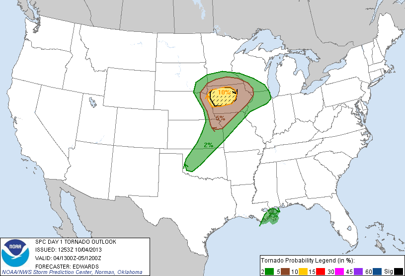
Above is the latest severe weather outlook for today and tonight, and is the portion that specifically addresses the potential for tornadoes, which will be highest within the brown and yellow shaded areas. A strong tornado or two is also possible, mainly within the black hatched area.
A threat for large hail and damaging winds will extend well to the South into portions of Oklahoma and northwest Texas as well, with some of the hail likely to exceed 2 inches in diameter in the black hatched areas on this image:

It's been awhile since we've seen a pronounced severe weather threat across a good chunk of the nation, so please be sure to keep an eye to the sky and listen for local updates and warnings as the afternoon and evening progresses.
Unfortunately, a good deal of the activity will take place after dark and into tonight. If you live across this region, please make sure that you have a way to receive weather warnings at night.
For more information from 'The Original Weather Blog', including shorter, more frequent posts during rapidly changing weather events, please be sure to follow me on facebook and twitter:


