The above image shows all Tornado and Severe Thunderstorm Watches currently in effect via the SPC in Norman, OK. If it weren't for about a 50 mile stretch near the Big Bend in Texas, watches would be in effect from the Mexican to the Canadian borders at this time.
As you can see in the latest radar mosaic image below, thunderstorms continue within the watch areas from Canada to near Mexico:
The line is moving toward the East (fastest on the Northern end), while individual thunderstorms are moving Northeast at anywhere from 30 mph in Texas to nearly 70 mph in Wisconsin!
Residents of the severe weather watch areas should remain alert overnight. Keep your NOAA Weather Radio or other weather information source handy should severe weather threaten your area.
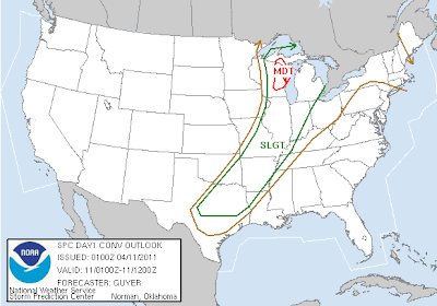
Below is the latest forecast from the SPC of additional areas of severe weather potential overnight:
If you live anywhere in the green or red outlined areas, even if you're not currently under a watch or warning, keep abreast of the latest weather information should threatening weather approach your area.


No comments:
Post a Comment