Here is what they are forecasting for temperatures:

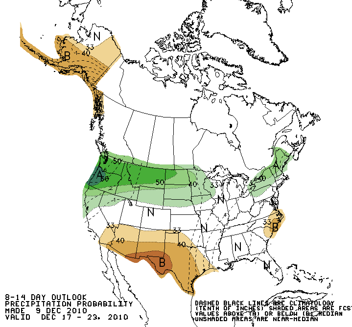
...and precipitation:
...and here is an image depicting the "mean" (or average) upper level flow pattern that accompanies the above forecasts for the same time period:

You can roughly interpret the forecast flow/location of the jet stream in the above map by focusing on the bands of green lines that run from Northwest to Southeast across the country. The particular pattern shown above does not generally reflect significant movement of cold air and/or storminess across the nation as a whole.
This trend is reflected in the first two maps, the temperature and precipitation departures from normal (where "B" = Below Normal, "A" = Above Normal and "N" = Normal). As you can see, the forecast calls for normal to above normal temperatures across the majority of the nation, with only a small region of below normal temperatures forecast along portions of the East coast.
As far as precipitation is concerned, the forecast of normal to below normal rain chances across the majority of the nation also reflects the rather inactive jet stream pattern described above.
There currently aren't even any indications that a significant disturbance is "waiting in the wings" to impact the nation right after Christmas, if the above flow pattern forecast verifies. We're still obviously about 15 days away from the big day, so we have plenty of time to monitor the trends and post any updates, but right now it looks like pretty quiet travel weather for most of the nation during the immediate period leading up to Christmas.
No comments:
Post a Comment