Well, changes are on the way, not only for my area, but most of the nation by Thanksgiving Day. Below is the latest HPC surface forecast map valid for 6am CST on Thanksgiving Day. I have highlighted areas with the greatest chance of rain (in light green) and snow (in light blue). Otherwise, expect windy and much cooler conditions across most of the Plains & Midwest, behind a strong cold front:

Heaviest rainfall is likely to occur along and South of the warm front across parts of the Ohio and Tennessee Valley areas. Below is the latest total rainfall forecast from the HPC, again valid Thanksgiving Day:
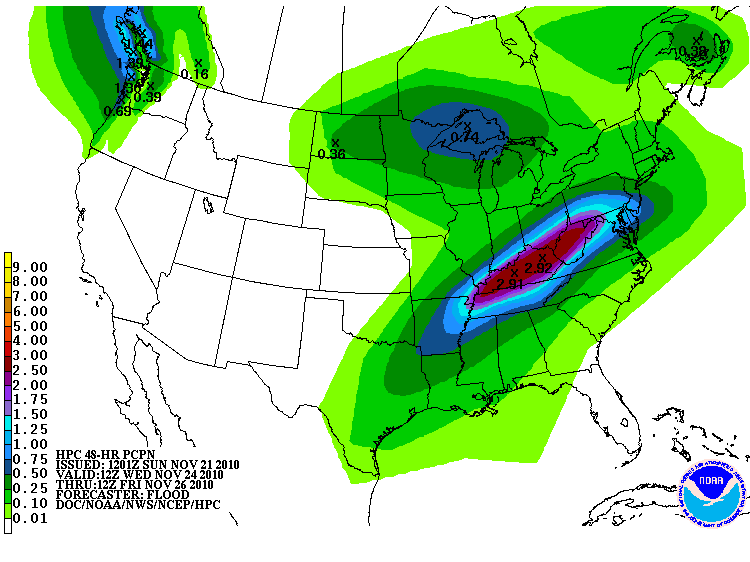
Meanwhile, locally heavy snows will be possible across portions of the upper Midwest, mainly from Minnesoate into adjacent portions of Wisconsin and Canada.
More on this in the coming days...
No comments:
Post a Comment