Showing posts with label Weather Technology. Show all posts

Wednesday, October 3, 2012

Snow Flying Across Parts of North Dakota...


Above is an image from the NWS radar site at Bismarck, ND, which has the new "dual-polarization" technology on board (for more on that, see this post from earlier in the year).  

The light blue shading shows the radar's depiction of snow, but we get a little more detail than that thanks to the new dual pol technology.  As you can see on the scale to the left side of the image (blown-up below), that shade of blue corresponds with "DS", which stands for Dry Snow, meaning that the radar is detecting smaller, dry or powdery snowflakes.  The term "WS" (right above DS), stands for Wet Snow, which would indicate larger snowflakes with higher moisture content.

This should allow us to be more precise in estimating the intensity of wintry precipitation across the country this upcoming season.


Surface reports indicate that snow is beginning to accumulate across portions of western North Dakota.  So far, we've received reports of 2.0 inches at Billings and Slope, 3.0 inches 1 mile East of Dickinson and 3.5 inches to the East/Northeast of Grassy Butte.

A recent shot from KQCD's tower camera in Dickinson shows rooftops and even some parts of the ground are becoming covered in white:


Up to 4-6 inches of snow is forecast tonight in a band from west-central through central North Dakota, including the Dickinson and Jamestown areas, as well as across a large area between Bismarck and Minot.

For more information from 'The Original Weather Blog', including shorter, more frequent posts during rapidly changing weather events, please be sure to follow Rob on facebook and twitter:
 

If you are in need of customized, site specific weather forecasts or storm warnings for your company or event, be sure visit Rob's professional webpage at WeatherGuidance.com.

Tuesday, September 25, 2012

One of Our "Eyes in the Sky" Goes Blind...


Above is a recent water vapor satellite image of the lower 48 United States.  I'm sure your attention is immediately drawn to the right hand side of the image which is "blank" insofar as cloud cover (or moisture in the clouds) is concerned.  That's not a simple software glitch, as one of the GOES Weather Satellites used to produce the full image, GOES-13 or "GOES East" is out of service.

The problem began a few days ago when images from the GOES East satellite started to become "noisy", as shown in the comparison below:

"Noisy" GOES East Image from 9-21-12

What the Image Should Look Like

The problem worsened on Sunday night, and the unit was taken completely out of service early yesterday.  

The fact that the satellite orbits the earth at an altitude of 22,300 miles above the surface makes fixing it very difficult, to say the least.  Engineers on the ground are attempting to "remotely" fix the problem, but if they can't, then the satellite will likely be taken out of service permanently.

In the meantime, NOAA has repositioned a "standby" satellite, GOES 14, and it is now generating the images that GOES East used to be responsible for.  Many satellite imagery display systems, such as the one shown in the image at the top of the post, will have to be reprogrammed in order to display the images from the "new" satellite.  

Thankfully, there were no significant tropical systems taking place in the Atlantic during the outage, or our observational abilities would have obviously been severely hampered.

For more information from 'The Original Weather Blog', including shorter, more frequent posts during rapidly changing weather events, please be sure to follow Rob on facebook and twitter:
 

If you are in need of customized, site specific weather forecasts or storm warnings for your company or event, be sure visit Rob's professional webpage at WeatherGuidance.com.

Friday, August 17, 2012

GOES-14 Satellite In "Super Rapid Scan" Mode for Several Weeks...


Meteorologists and weather enthusiasts are in for a treat over the next several weeks as one of the GOES weather satellites (GOES 14 to be exact) has been placed in "Super-Rapid Scan Mode".  This means that satellite pictures will be taken once every minute, compared to the 15-30 minute scans that we are normally presented with.

The trick is, the special scan's won't cover the entire nation or the entire Northern Hemisphere.  Various "sectors" will be chosen for this special scanning mode based on ongoing and forecast weather conditions, etc.

For example, today the focus is on the Southeast, and you can see a beautiful one-minute frequency visible satellite loop (one of the frames is shown above) by going to this link.

The schedule for tomorrow showss that the super rapid scan imagery will be focused on now Tropical Storm Helene (shown as "Tropical Invest" on the schedule).  It will be awesome watching a tropical system with 1 minute satellite intervals (albeit so close to land).

The Super Rapid Scan Mode is scheduled to continue on "select days" through October 31st.  For more information see this post on the CIMMS blog page.


For more information from the Original Weather Blog, including "live blogging" during rapidly changing weather events, please be sure to follow me on facebook and/or twitter:
 

Tuesday, May 1, 2012

HRRR Computer Model No Longer "Experimental" As of Today...


Regular readers of the blog will recognize an image like the one above. It's a computer forecast model representation of what the radar will look like at a specific moment in time, up to 18 hours in the future.  The computer model is called the High Resolution Rapid Refresh, or "HRRR" model.  (I should point out that was the original name of the model, and is still listed in many cases on its webpage, however the National Weather Service (NWS) will be calling it the "RAP" model).

The NWS has been experimenting with the model over the last several months.  Effective today, it is being used in real time.  You can read more about the specifics of what the model does and how it will be used by going to the NOAA press release.

One example cited in the press release shows the performance of the model in a heavy rain situation over the High Plains on June 21, 2011.  As you can see in the image below, the RAP model correctly forecast heavy rainfall along the Kansas/Colorado border, whereas the previous short term model, the RUC (Rapid Update Cycle) missed the forecast pretty badly in that area:


Overall, I've been quite impressed by the model's performance in both winter weather and severe weather situations.  I will continue to post some more examples of how the model can be used in future articles...

For more information, including "live blogging" during rapidly changing weather events, please be sure to follow me on facebook and/or twitter:
 

Monday, April 9, 2012

Severe Weather History: First Radar Indicated Tornado Signature on this Date in 1953...


The above YouTube video shows the first ever radar indicated tornado signature (also known as a "hook echo"). It was captured on this date back in 1953 on a radar being tested by the Illinois State Water Survey in Champaign, IL.  

The parent thunderstorm went on to produce the tornado shown below:


Needless to say, technology has advanced quite a bit since the 1950s and 1960s when meteorologists and forecasters sat in darkened rooms watching for the latest sweep of the radar scope, hoping to make something out on the blurry screens.

In a recent post I described the benefits of the latest round of radar technology, dual polarization, which is currently being launched at National Weather Service radar sites around the country.   You can view that article by going here.


If you enjoy the blog, please click on the icons below to "Like" my facebook page and/or follow me on twitter. You'll find posts at these locations that aren't always on the blog, especially during rapidly changing weather situations...
 

Tuesday, April 3, 2012

New Technology Coming "Soon" to a Radar Site Near You...


The National Weather Service radar in New Braunfels, TX (which serves the Austin and San Antonio Metro areas) was just put back online about an hour ago after the "dual polarization upgrade" was complete.  It will be interesting to see how the radar performs during the severe weather event that is expected to take place this afternoon.

With this and many other sites coming online recently, I thought it would be appropriate to put the following post regarding Dual Polarization Radar back up to the top of the blog.  The original post from July 9, 2011 follows below:

The first major upgrade to the National Weather Service's WSR-88D radar network in over 20 years is getting underway across the country. The latest technology being rolled out is called "Dual Polarization".

"What the heck is that???" and perhaps more importantly, "what's in it for me???" - you ask?

In a nutshell, the conventional WSR-88D radar sends out a single pulse of radar energy into a storm, which captures a generally horizontal snapshot of raindrops, hailstones, snow flakes, etc. (as shown on the left half of the illustration below): 


The right half of the same illustration shows what Dual Polarization technology will do.  The radar will not only send out a horizontal pulse of energy (red) but also a vertical pulse (blue), which will give us a far greater depiction of the size, shape and density of raindrops, hailstones, snow flakes and other targets.

Dual Polarization (also known as Dual-Pol for short) radar technology has been installed and tested for a number of years at the NSSL in Norman, OK.  Within the last few months the rollout to operational NWS radar sites has begun.  The first site to be installed was at Vance AFB, OK, followed by Phoenix, AZ and Morehead City, NC.  As this is being written, Dual-Pol is currently being installed at radar sites near Pittsburgh, PA and Wichita, KS.  A complete schedule of the rollout, which will continue into early 2013, is located here.  Each installation takes about 2 weeks to complete, during which time the radar unit will be out of service to allow for both the upgrade and training at the local NWS office.

Now that we know what Dual-Pol is, what will it do for us?  Perhaps the greatest initial impact will come in the form of vastly improved precipitation estimates.  With the current WSR-88D technology, a thunderstorm must be in existence for about 1 hour before the radar is able to estimate how much rain is being produced.  With Dual-Pol technology, we'll receive a nearly instantaneous read on rainfall rates.  This will obviously have enormous potential not only in regard to flash flooding & other severe rainfall situations, but also in dealing with snowfall, ice accumulations, etc.

Dual-Pol rainfall estimate (left) vs. WSR-88D estimate (right)

Current technology on the WSR-88D sometimes makes it difficult for the radar to differentiate between hailstones and raindrops, particularly at greater distances from the radar site.  As a result, the 88D often over estimates the rainfall rate with severe storms (mis-identifying hail as heavy rain).  The Dual-Pol technology will make the estimates more accurate in these situations (see the above image for just one example).

Dual-Pol technology will also aid in the tornado warning process.  Right now, it takes a fairly large debris field (which usually means a fairly large tornado) to produce a debris signature on the WSR-88D.  A Tornadic Debris Signature (or TDS) can be detected by Dual-Pol radar in association with a much smaller debris field (which means a smaller tornado).  Please note that I am talking about debris being detected by the radar here, not rotation.  In the database that was used to develop some of the algorithms for the new Dual-Pol radar system, debris signatures were observed with tornadoes as weak as EF2 intensity (winds of 111-135 mph).  Today we would normally only see a debris signature on the WSR-88D in association with a tornado of high-end EF3 to EF4 intensity or greater (roughly 150+ mph surface wind speeds). 


The above image was taken from the Dual-Pol radar at the NSSL radar testbed in Norman, OK.  The white and pink colorations within the white circled area on the image shows where the Dual-Pol is detecting tornadic debris.  This debris field was not as easily identified on conventional radar.   Of course, you must also keep in mind that the tornado, regardless of strength, would have to be in an area where debris could be picked up before the radar would be able to see it.

Dual-Pol technology is likely to be of particular help in the tornado warning process in 2 specific areas:  (1).  when the circulation is rain wrapped and not easily visible by storm spotters and (2).  when the circulation is occurring at night and not easily visible to storm spotters.

The system will also be a big help with non-precipitation events as well.  Because it takes a more detailed "slice" through the atmosphere, Dual-Pol technology will be able to forewarn of local hazards near the radar site, like dust storms for example.  Below is an image taken by the Dual-Pol radar near Phoenix, Arizona this past Tuesday, July 5th:


The red dashed line notes the leading edge of a wall of dust that was advancing toward the city from the South.  Here is what that advancing dust cloud looked like outside the National Weather Service office:


The enhanced scanning of the atmosphere very near the earth's surface by the Dual-Pol radar will allow it to detect very small particles, like the dust particles above, as well as insects, birds, etc., close to the radar site.  The WSR-88D is already able to do this to some extent, but the resolution and detail of such scans will be even greater with the new Dual-Pol technology.

Now that we have a few Dual-Pol radars online and others being added about every 2 weeks, I'll be posting some images of the new technology in action, and comparing it to the old where possible.  Stay tuned!


If you enjoy the blog, please click on the icons below to "Like" my facebook page and/or follow me on twitter. You'll find posts at these locations that aren't always on the blog, especially during rapidly changing weather situations...
 

Friday, March 30, 2012

Computerized Art Project Takes a Cool Look at the Wind...


Digital artists Fernanda Viegas and Martin Wattenberg take a cool look at near real-time wind flow in this piece (still shot above, video clip below):


The link to the webpage (which looks much crisper than the clip above and will display near real time data), is here.  It works best using the Google Chrome browser.

The programmers used the National Digital Forecast Database to generate the wind flow pattern (called streamlines in meteorology) in near-real time (the forecast is usually valid within an hour of the current time).


New to the blog?  Welcome!  Please click on the icons below to "Like" my facebook page and/or follow me on twitter.  You'll find posts at these locations that aren't always on the blog, especially during rapidly changing weather situations...
 

Thursday, March 1, 2012

Interesting Look at Rotation on Tuesday Night / Wednesday Morning's Storms...


The above image was provided by the NOAA Environmental Visualization Laboratory (EVL). It shows the output of a computer algorithm which attempts to identify where rotation in a storm (as indicated on area radars) may be strong enough to produce a tornado on the ground.  The algorithm uses a combination of wind and hail data to arrive at its conclusions.  This particular image shows the output of that data for the storms of Tuesday evening (February 28th) and early Wednesday morning (February 29th) of this week.

I have taken the same image and added the locations of the 4 cities that were hardest hit by tornadoes that night:  Branson, MO, Buffalo, MO, Harveyville, KS and Harrisburg, IL (click to enlarge):


A scale isn't provided, however the lightest shadings indicate the weakest rotational/tornado signature, and the darkest indicate the strongest signatures.

As you can see, the storm responsible for producing the Branson area tornado actually began rotating as it moved through Tulsa, and continued doing so all the way across the southern edge of Missouri and into extreme southern Illinois and extreme southwest Kentucky!

The storm responsible for the EF-4 tornado in Harrisburg, IL began showing strong rotation over southcentral Missouri (to the Northeast of the Branson storm).  

Both the Buffalo, MO and Harveyville, KS storms also showed relatively strong signs of rotation on radar well before they actually produced tornadoes on the ground (yet they too did not produce a tornado for the entirety of the rotational cycle).

Herein lies the challenge to the meteorological community:  lots of severe storms rotate, but not every rotating storm produces a tornado on the ground.  To further complicate matters, we have yet to establish any type of rule of thumb that says something like "a storm rotating at such and such velocity will generally produce a tornado 90 minutes after it starts rotating..."

This problem is by no means new, yet it is one that needs to be solved quickly in order to improve the current tornado warning system.  Until then, you are likely to continue to feel "overwarned" from time to time as meteorologists struggle with when to issue a tornado warning based off of radar with no ground truth data available to support the decision.

One step in the right direction is the ongoing upgrade of existing NWS radars to dual polarization technology.  You can see my post here for more details on what that technology promises to bring.

The Springfield, MO radar (which is the site nearest Branson) had the new upgrade in place prior to Tuesday's storms.  The output from that radar clearly showed a strong signature of tornado debris as the storm moved through Branson on Tuesday night:


Branson is located near the center of the image.  The dark blue and light green pixels indicate the presence of the debris associated with the tornado that was ongoing at the time the image was taken.

If you've been reading the blog for very long, you know that it's not unheard of for a debris ball to show up on radar (even before the upgrade).  What is unusual about the above image taken by the new technology on Tuesday night is that the Branson tornado was "only" rated EF-2 intensity.  In the past, with the old technology, a debris ball would not typically show up with a tornado that "weak" (most of the tornado debris ball signatures we saw last year with the old technology were EF-4 intensity or higher).

The ability to potentially detect the debris signatures of weaker and/or shorter lived tornadoes is a very promising advancement, indeed!

Several of the radars in the areas to be affected by severe weather tomorrow have recently been upgraded to the new technology as well.  I plan to monitor that new data tomorrow evening and will be sure to post any interesting findings...


If you enjoy reading 'The Original Weather Blog', please be sure to "like" our facebook page!

Tuesday, January 24, 2012

If You Don't Have a NOAA Weather Radio...

Severe weather can be particularly dangerous and life threatening at night. If you don't have a NOAA Weather Radio with a battery back-up to provide overnight warnings for your area, but you do have a smartphone, please check your "app store" for a relevant tool.


If you have an iPhone, you might want to take a look at the iMap Weather Radio app.  It functions just like a traditional weather radio, only better.  It uses GPS technology to track your exact location and alert you only to watches and warnings that are issued for that particular area.

I have only begun to evaluate the app this evening as severe weather is threatening my area.  So far I am impressed.  When a Tornado Watch was issued a short while ago, the app alerted me even a few seconds before my NOAA Weather Radio did.  

You can set the app to alert you based on your GPS-fixed location, or you can enter up to 5 additional locations manually (to keep an eye on friends, relatives, etc.).  Once your location(s) are set, the app will alert your via live audio as well as an on screen text alert (the photo below is only an example):


I will continue to evaluate this app tonight and will provide a detailed review very soon.

If you have a Blackberry, Android or are using any other mobile platform, please check this link for possible weather alert apps.  I have not yet evaluated any of these apps in any way - so I cannot personally comment on  their performance at this time.

I'm not here to "endorse" a particular app, but to make sure that you choose some method of receiving severe weather warnings at night for your area.  A NOAA Weather Radio with battery back-up is still my favorite choice for now, but smartphone apps are beginning to run a close second.

If you enjoy reading 'The Original Weather Blog', please be sure to "like" our facebook page!

Tuesday, November 29, 2011

A Look At Yesterday Evening's Snow in the Deep South...


The image above shows snow depth as estimated by satellite imagery and computer models across the middle and lower Mississippi River Valley region at 6am CST this morning.   This particular image is from the Interactive Snow Information site via NOAA.  Below is a slightly different (geographically speaking) representation via NOAA's National Snow Analysis Center:


As you can see on both of the images, there are 2 patches of heavier snow depth indicated (on the order of 4-8 inches):  the first over extreme northeastern Arkansas, and the second over southeastern Missouri.  In fact, storm reports indicate 8.0 inches of snow fell near Paragould and 6 inches of snow fell near Jonesboro, both in Arkansas.  A report of 4.5 inches of snow came in from Caruthersville, Missouri:


Yesterday evening I posted an image from the experimental HRRR forecast model, which was calling for locally heavy snow across much of this region yesterday evening and overnight.  Below is the accumulated snowfall forecast from that model valid at 6am CST this morning, the same time that the observations were taken on each of the 3 images above.  The image was produced by the model at 5pm CST on Monday, approximately 13 hours before the valid time:


As you can see, the model did an outstanding job forecasting the heavier snow band across extreme northeast Arkansas and southeast Missouri.  It correctly forecast 6-8 inches of snow across this region (darker yellow and orange colors on the image).


On the other side of the coin, the model over-forecast the magnitude of the snowfall in Memphis, calling for 3-4 inches (around 1 inch was reported in most areas).  Truth be told, had the ground been colder in Memphis, they would have had more significant accumulation (and this was pointed out in the posts that I made yesterday afternoon).


All in all, I'd say the HRRR performed quite well in this event, and if you ask any meteorologist, snowfall forecasts are among the toughest calls.  I plan to keep an eye on the performance of this model in other snow events this winter and will post any relevant updates and/or observations.


In fact, it looks like we'll have an opportunity to test out the model this weekend in the Plains.  Watch for a more detailed post on this impending winter storm later this evening...


If you enjoy reading 'The Original Weather Blog', please be sure to "like" our facebook page!

Tuesday, November 22, 2011

What Do I Mean By A Lack of Consistency?

In a post earlier this evening regarding the potential for a major cooldown and associated storm system this coming weekend, I mentioned several times about how the computer model guidance is still inconsistent in handling the system.


As an example of what I was talking about, take a look at how the GFS model diverges over time in handling the system.  The GFS is made up of an ensemble of 20 different computer model solutions that are merged together to reach a "consensus".  Each of the ensemble models is represented by a different colored squiggly line on the images below.  The lines represent what you would generally refer to as the subtropical (Southern) and polar (Northern) branches of jet stream wind flow across the U.S. at each given time period.


The ensembles start out in near unanimous agreement, as to the position of each branch of the jet stream, as shown on the image below (valid 6pm CST tomorrow, Wednesday, evening):


By 6pm CST Friday, the consensus is beginning to shift apart just a bit:


...and by 6pm CST Sunday, it's a big squiggly mess out there:


...and now you know why the Hair Club for Men (and the female version I'm sure) is a favorite among meteorologists at this time of the year...


Stay tuned, there's lots more hair pulling to come on this one...


If you enjoy reading 'The Original Weather Blog', please be sure to "like" our facebook page!

Saturday, August 27, 2011

3-D Satellite Radar View of Irene


A cool image of the center of Irene as taken by NASA's TRMM satellite radar project yesterday evening. You can read the full article and details on the project here.


If you enjoy reading 'The Original Weather Blog', please be sure to "like" our facebook page!

Tuesday, July 5, 2011

Outdoor Warning Sirens to Sound Less Frequently in Indianapolis


According to this article on WTHR.com, effective today, outdoor warning sirens (often referred to as "tornado sirens") will only be sounded in Marion County, Indiana (which includes the city of Indianapolis) when:  (1).  a Tornado Warning is issued or (2). a funnel cloud/tornado is reported on the ground by the NWS or a public safety officer.


This is certainly good news as it will hopefully help to cut down on the false alarm rate / "cried wolf syndrome" in the Indianapolis area.  With that said, I'd like to point out (as I have done so often on this blog) that outdoor warning sirens are called "outdoor" warning sirens for a reason - they were designed to be heard by folks that are outdoors.  If you live near one, you may be able to hear it indoors as well, but that's not what they were designed for.  


To ensure that you and your family are safe during severe weather situations at home, work or school, I strongly suggest that you purchase a NOAA Weather Radio with a programmable alert mode which will sound an alarm whenever severe weather threatens your specific area.  You can even program the radio to only alert you to specific types of threats (i.e., tornadoes, severe thunderstorms, flash floods, winter storms - or all of the above).  The model that I linked to in the first sentence of this paragraph (which is available at RadioShack) even has a Skywarn spotter band that will allow you to hear severe weather reports in your area live as spotters observe the threat!


If you enjoy reading 'The Original Weather Blog', please be sure to "like" our facebook page!

Monday, June 13, 2011

Severe Weather Safety and Preparedness: Part 1 - Severe Weather Safety Kit

This post is part 1 of a 2 part series on Severe Weather Safety and Preparedness.  This first installment deals with the creation of a Severe Weather Safety Kit for your home or business (I recommend having one in both places if you live in a severe weather prone area).  The 2nd installment, available here, deals with where and when to seek shelter during various severe weather situations.


There are several essential items that everyone should have in their severe weather preparedness kit, whether for severe thunderstorm and tornado season, hurricane season, or even winter storm season.  The most important that immediately come to mind are:  

(1).  A NOAA Weather Radio with a battery back-up
(2).  A flashlight and/or emergency lighting source
(3).  Batteries and/or emergency power sources
(4).  Basic first aid kit
(5).  Emergency food and water supply

Lets take a look at each of these items in greater detail.  Where applicable, any retail prices shown are "regular price" at the indicated retailer.  Keep in mind that these items often go "on sale" as well.  As I always say:  regardless of where you buy the items, just make sure that you have them on hand as a part of your severe weather safety kit before severe weather season begins!


(1).  NOAA Weather Radio w/battery back-up:

There are literally hundreds of various types of this item on the market.  I'd like to show you 3 that I either personally own and use now, or have at some point in the recent past:

NOAA Weather Radio with Alarm Clock  $29.99 at RadioShack:


This is the most basic type of Weather Radio.  It is capable of receiving all 7 frequencies of NOAA Weather Radio (NWR) stations and features an audible alarm that will sound whenever a severe weather watch or warning is issued within the transmitter's coverage area.  Plugs into a standard AC outlet, and is also capable of running on 4 AA batteries (also ideal for power outage situations).  LCD clock features an alarm with snooze option.


This unit is a step above the previous, featuring state of the art SAME functionality.  SAME stands for "Specific Area Message Encoding", which allows you to program the unit to only sound an audible alarm for severe weather watches and/or warnings that will affect your specific area only (by county).  If you don't want to mess with programming the radio yourself, anyone at your local RadioShack store would be glad to do that for you.

Like the other radio, this one also features an LCD display with built-in alarm clock.  It plugs into a standard AC outlet, or can function on 6 AA batteries (which, again, is very important in situations involving a power outage).

For additional details on weather radios (including other model options), please see my post titled "NOAA Weather Radio Buyer's Guide".


(2).  A flashlight / emergency lighting source:

ICON Rogue flashlight  $39.99 at RadioShack:


Of all the various types of flashlights I have, this one is probably my favorite.  It's heavy duty, made of a very durable aluminium body yet relatively light weight and compact which makes it easy to throw in your pocket.  At the same time, the Rogue puts out a lot of light.  In fact, two levels of light output are available - controlled by a LED that never needs replacing!  This flashlight is waterproof up to 1 meter for 30 minutes and perhaps best of all, it only requires 1 AA battery to operate!


This is a recent addition to my home's severe weather preparedness arsenal, and I must say that I've been very impressed with this little unit.  Plug it intoa wall outlet in an important (traffic-wise) part of the house, like a major hallway or the kitchen, etc.

The unit charges from the wall outlet and has a couple of functions, first serving as a soft LED nightlight (which is automatically triggered by a small sensor on the front of the unit).  More importantly, if the power goes out, a bright light shoots from the top of the unit, giving emergency lighting.  You can also unplug it from the wall outlet and use it as a flashlight on your way to the breaker box or to get the rest of your severe weather gear rounded up in such an emergency.

RadioShack also makes a donation to the American Red Cross with each unit purchased.


(3).  Batteries and/or emergency power sources:

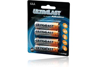
Of course, any good severe weather preparedness kit would contain a variety of alkaline batteries (the items we've featured so far in this post require AA batteries almost exclusively).  


However, in today's modern technological world, simple alkaline batteries won't always do the trick.  If your house is like mine and mainly relies on cellular phones (and/or smart phones) for communication, you'll want to be sure to have a backup battery charging source for these devices as well:


Enercell Portable Power Bank  $49.99 at RadioShack (and other retailers - search online at Amazon and other sources for possible lower prices if you have time to order one and have it shipped):


Before the storm hits, just plug this unit into the USB port of any computer and charge it up.  If the power goes out later on and the battery runs down on your cellphone, smartphone or similar device, just plug it into the Enercell for up to an additional 8 hours of talk time (depending on usage).

Package includes a USB-to-mini USB cable, a mini USB-to-micro USB tip and an Apple cable to fit the vast majority of devices out there today.

Another excellent emergency power source to have on hand (I have 2 of them) is the Enercell Power Inverter, ($39.99 regular price at RadioShack) or similar item:


You simply plug this item into the cigarette lighter of your vehicle (make sure the tank is full before the storm hits, and obviously keep the garage door open when running the car!) and you can then plug in any AC or USB power cord to provide power.  As long as you have gas in the tank, you can continuously charge (or directly provide power to) any compatible item (such as your laptop computer, cellphones, etc.).


(4).  Basic first aid kit:


Basic first aid kits are available for $15-20 at most big box retail stores, drugstores, or online.  A first aid kit can be as simple or elaborate as you choose, but make sure it includes the basics to get you by in case of an injury sustained during a severe weather event.  

Most pre-made kits include a variety of bandages, sterile wipes, and even pain relievers.  You can also put together a kit on your own for about $10.  Don't forget a small supply of emergency insulin if there's a diabetic in the house!


(5).  Emergency food & water supply:


It's also not a bad idea to have a case or two of bottled water and some non-perishable food items such as granola bars, fruit snacks or mixed nuts, etc., on hand just in case the power goes out for an extended period of time and you are unable to save perishable items.  If the grocery store is out of power too, it might be awhile before you can get back and restock.

If you have a propane powered hot plate and plan to warm up some canned soup, don't forget to have an "old school" manual can opener on hand!

You can also find prepackaged Emergency Food & Water Kits if you don't want to make one up on your own.  Many of these also include a first aid kit as well.


A severe weather preparedness kit can be as elaborate or as simple as you wish to make it.  Regardless of the type you choose to put together, try to make sure and include the above items so that you're ready to handle the next severe weather event that strikes your area.


If you enjoy reading 'The Original Weather Blog', please be sure to "like" our facebook page!