Showing posts with label Severe Weather Update - TX. Show all posts

Tuesday, January 29, 2013

Severe Weather Update for Texas...

Thunderstorms are developing southward into extreme northwest Texas along the cold front at this hour:


...and I expect them to increase in coverage and intensity and sweep through most of northcentral and northeast Texas this afternoon...including the DFW Metroplex region.  Damaging wind gusts and hail will be the primary threats, although an isolated tornado spin-up cannot be ruled out.

If any isolated storms are able to develop and become organized ahead of this line, the localized tornado threat would increase with such cells.

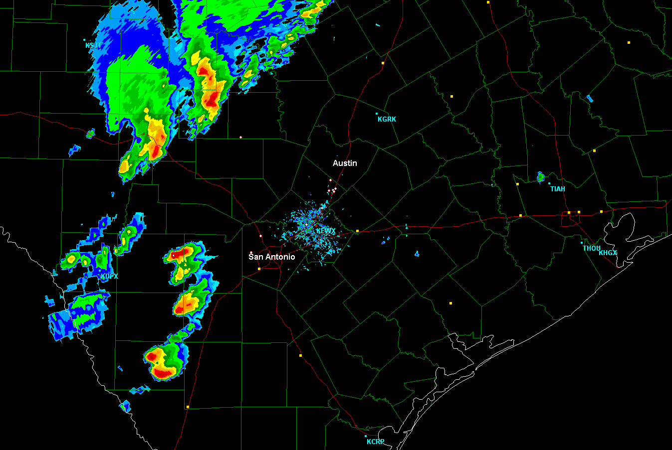
Further South, including the Austin-San Antonio corridor along I-35, its coming down to a battle of the atmosphere.  The low levels are very moist and will become increasingly unstable throughout the day, however a relatively strong "capping inversion" (also known as a "lid" - see the oldie but goodie link for details) is in place across the region.

Strong instability and increasing support from the upper level storm approaching from the West is likely to be able to overcome the cap and allow for thunderstorm development down at least part of the I-35 corridor later this afternoon... but the question is how far South?

One way to measure how unstable it is in the lower atmosphere is to look at an index called CAPE (convective available potential energy).  The current CAPE analysis shows high values starting to "pool" along the dryline in west-central and southwest Texas, as indicated by the green shaded area on the image below:


This pocket of instability is forecast to move Eastward into the Austin-San Antonio corridor and become even more unstable later this afternoon, as indicated by the brighter yellow shaded area on the forecast image below (valid at 3pm):


This could indeed be enough of a "push" to allow for thunderstorm development as far South as the Austin-San Antonio area late this afternoon.

As I've been saying for a few days now... this is one of those "all or nothing" situations.  If a storm is able to break through the cap and form in this region, it will tap that high instability and could become severe quickly, with large hail, damaging winds and an isolated tornado possible.

I would place the chance of a thunderstorm at 30-40% in Austin, 20-30% in the Kyle/Buda areas, and 20% in San Antonio.  If a storm is able to form in any of those areas, the chance of severe weather would be relatively high, so stay alert!

For more information from 'The Original Weather Blog', including shorter, more frequent posts during rapidly changing weather events, please be sure to follow me on facebook and twitter:
 

Coming March 2013:  The Tornado Chronicles full website!
• Interactive tornado database back to 1950 (earlier years coming soon)
• Interactive radar with live warnings and street-level zoom
• Tornado safety, preparedness and education
• Daily tornado outlooks/threat index
• Photos, videos & more!

Please show your support and follow The Tornado Chronicles on twitter and on facebook for the latest updates on tornadoes and the upcoming website!

Tuesday, January 8, 2013

Strong to Severe Storms, Torrential Rain for Austin / San Antonio Tonight...


The latest radar composite image above shows thunderstorm activity forming along the Rio Grande river along the Texas/Mexico border.  The pink outlined area shows where the Storm Prediction Center (SPC) is monitoring for a possible severe weather watch this evening.

This activity will increase as it moves Northeast, spreading toward the I-35 corridor from Austin to San Antonio by late this evening.  Scattered storms may form ahead of this activity and produce a brief downpour across the region this evening, but the main "show" for the Austin-San Antonio corridor will come after 10pm and into the overnight hours, as several rounds of showers and heavy thunderstorms move across the region.

Very heavy rainfall, frequent lightning and strong (possibly damaging in some cases) wind gusts will be the primary threats with the activity late this evening and tonight.  A few tornadoes are also possible, but they should be generally brief in duration.  While the brevity is nice from a hazardous weather standpoint, it certainly makes identifying them on radar very difficult as the circulations are usually very short lived.  It's also not much consolation if the "brief" tornado happens to hit your house, or the home of someone that you care about, so please don't let the word "brief" catch you off guard.

If you're staying up late tonight (or are awakened in the night), keep an eye out for "dog leg" or "comma head" configurations on radar.  They look something like this (within the white circled area):


Those signatures are often associated with a broad circulation within the lower levels of the thunderstorm, which often produces damaging winds and/or a brief tornado at the surface.  (That image is from the event that took place almost one year ago, 1-25-12, and produced an EF-1 tornado in northeast Austin just before 3 a.m. CST).

In addition to their relative brevity, these types of circulations tend to be hidden within large areas of heavy rain, which make them difficult (if not impossible) to view, not to mention the fact that it will be dark outside.   So, these types of situations should not be taken lightly.  If threatening weather approaches your area, take shelter as if a tornado had been sighted, that way you know you are protecting yourself and your family as best you can until the storm passes.

If you live along I-35 in southcentral Texas, including the Austin/San Antonio areas, please make sure that you have a way to receive weather warnings overnight tonight.  It's still not too late to do so even at this hour, as you can make a quick trip to the store or even download an app or plug-in on your computer and/or phone!

Rainfall will be torrential at times, with widespread amounts of 2-4 inches likely, and localized amounts of 4-6 inches possible by the time the precipitation ends, which will be between 10am and 12 Noon tomorrow:


Based on the forecast, this will be the most substantial rainfall event for the I-35 corridor from Austin-San Antonio in almost 1 year (possibly more if greater than 5.66 inches of is received).  Looking at the records from the Austin Bergstrom Airport, the last time that a significant rainfall has taken place is as follows:

0.50" or more:  10/11/12 (0.50")
1" or more:  9/29/12 (1.55")
2" or more:  8/18/12 (2.85")
3" or more:  1/25/12 (5.66")

Note the last date being the 1-25-12 event once again (as noted with the "brief" tornado comparison above).

The threat of severe weather and widespread heavy rainfall will shift East into east-central and southeast Texas, including the Houston area, tomorrow, so folks down that way should continue to keep an eye to the sky!

Stay tuned for more information on this situation as it continues to unfold.  I will most likely "pseudo-live" blog for the Austin-San Antonio areas later this evening and tonight as time allows between client updates.  If you don't already follow me on facebook, Google+ or twitter (see links below), please do so as those are the most likely places that I'll post short, more frequent updates (which is typical during an ongoing severe weather situation).

For more information from 'The Original Weather Blog', including shorter, more frequent posts during rapidly changing weather events, please be sure to follow me on facebook and twitter:
 
If you are in need of highly customized, site specific weather forecasts and/or storm warnings for your business, school or event, be sure visit my professional webpage at WeatherGuidance.com.

Tuesday, March 20, 2012

Severe Weather Update - Southcentral Texas...


Over the last hour, a tendency has developed for storms moving up the I-35 corridor to weaken once they cross to the North of I-10 in the San Antonio area.  This has resulted in a decrease in the severe weather threat for the Austin-Kyle-Buda area, particularly with respect to damaging winds, large hail and/or tornadoes.  

Some of the stronger storms that move into the northern part of the Austin-San Antonio corridor may still produce small hail and gusty winds of 30-40 mph overnight, however widespread severe weather does not appear likely at this time.

The threat of flash flooding, however, will continue across the City of Austin and much of Hays County, as additional storms producing heavy rainfall will continue to move North/Northeast across the same areas that have already received heavy rains.  Storm total rainfall amounts of 3-6 inches will be quite common during the overnight hours, with locally heavier amounts possible.

Further South, mainly to the South and East of the San Antonio Metro area, a more pronounced severe weather threat will continue through the pre-dawn hours, mainly in the form of large hail and strong, possibly damaging wind gusts.  Isolated tornadoes also cannot be ruled out in this region.

Flash flooding will also continue to be a pronounced threat in the San Antonio Metro area as well, with additional heavy rains yet to come on already saturated grounds.

If you live in these areas, make sure that you have a way to receive severe weather warnings at night.  Have your shelter prepared that way you can go there quickly if severe weather is observed or a warning is issued...

If you enjoy reading 'The Original Weather Blog', please be sure to "like" our facebook page!

Severe T-Storm Watch for Southcentral and Southeast Texas Until 9am CDT Tuesday...


The above Severe Thunderstorm Watch was just issued by the Storm Prediction Center in Norman, OK. It is valid until 9am CDT Tuesday and includes the cities of San Antonio, Austin, Kyle, Buda, Laredo, Houston, Corpus Christi and Victoria.

Large hail, damaging winds, torrential rains and dangerous lightning can be expected in these areas.  Isolated tornadoes also cannot be completely ruled out (please see this earlier post for details on that threat tonight in southcentral Texas).


If you enjoy reading 'The Original Weather Blog', please be sure to "like" our facebook page!

Monday, March 19, 2012

May Be Difficult to Give Advanced Warning of a Specific Tornado Threat in Southcentral Texas Overnight...


Above is a high resolution image of the San Antonio area radar taken just a moment ago (click to enlarge/clarify). I have circled, in white, 7 strong to severe thunderstorms - any one of which could produce a brief tornado at any given moment.  Such will be the situation as we progress into the overnight hours...

Rather than having conditions favorable for isolated, relatively "long" track tornado potential (as we saw earlier this evening near San Antonio), storms with the type of configuration we'll be seeing overnight (such as those shown above) tend to produce relatively short lived tornadoes, which can be difficult to detect on radar.

In many ways, the situation tonight is very similar to the one in which a tornado touched down in northeast Austin and caused extensive damage over a relatively small area in late January of this year.

So, my advice for tonight would be that if severe weather threatens your area, go ahead and seek shelter as if a tornado were taking place, even if a specific tornado warning has not been issued.  If you have a basement, go there.  If you don't, seek shelter in a small, interior room on the lowest floor of your residence.  By all means, stay away from windows.

Damaging wind gusts and large hail can also be expected with the activity overnight, as well as very heavy rainfall which will cause flash flooding in areas proned to such a threat.


If you enjoy reading 'The Original Weather Blog', please be sure to "like" our facebook page!   

Severe Weather Update - Southcentral Texas Including I-35 Corridor from Austin to San Antonio...


The two severe storms that produced tornadoes in and/or near the San Antonio metro area during the last 1-2 hours have diminished, causing no more than rain showers at this time.

Meanwhile, as you can see on the radar image above, back to the West, a line of strong to severe thunderstorms is slowly advancing Eastward toward the I-35 corridor.

Many of these storms are severe, with large hail and strong, damaging wind gusts.  Based on their present rate of movement, this activity will reach the I-35 corridor, including the Austin-San Antonio areas, toward Midnight.  Tornado development also cannot be ruled out as this activity progresses Eastward.

Very heavy rainfall can also be expected, which will lead to flash flooding in some areas.  

If you live along I-35, including the Austin/San Antonio area, make sure that you have a way to receive severe weather warnings overnight.  Prepare your shelter area so that you can get there quickly if threatening weather is observed or a warning issued.


If you enjoy reading 'The Original Weather Blog', please be sure to "like" our facebook page! 

Southwest San Antonio - Take Tornado Precautions...


A tornadic thunderstorm is moving East/Northeast along I-35 just to the Southwest of San Antonio. The circulation as indicated by radar is located very near Lytle, or about 12 miles Southwest of Loop 410 in southwest San Antonio.

Damage has been reported along I-35 between Lytle and Natalia in the last 15 minutes.

If you live ahead of this storm, seek immediate shelter.  Get below ground if possible.  Otherwise, seek shelter on the lowest floor away from windows.

This is a rapidly changing situation.  For more frequent updates, please follow my facebook and/or twitter pages.

Strong Rotation on Severe Storm Just SW of San Antonio...


Above is the latest image from the San Antonio area radar site.  Below is the same image in "velocity" mode, which shows the direction and speed of wind blowing toward and away from the radar.  The white circled area on each image (near Devine), shows the strong rotation that is indicated by the radar.  This means that a tornado is already on the ground, or a tornado could touch down at any time.


If you live in or just to the Northwest of Devine, Natalia and Lytle, you need to seek shelter immediately from this dangerous storm.  In addition to the threat of a tornado, very large hail (golfball size or larger) is also possible.  The large hail threat will extend North of the tornado threat, including the La Coste area.

This storm is moving Northeast at about 15 mph.  Folks ahead of the storm in southwest Bexar County, including the southwest side of San Antonio, should closely monitor the progression of this storm over the next couple of hours.

Listen to local media or another trusted source for the latest updates and possible warnings.  Make sure to identify your sheltering location ahead of time, that way you can get there quickly if a warning is issued for your area.

Severe weather can be especially dangerous at night.  Make sure that you have a way to receive severe weather warnings at night.


If you enjoy reading 'The Original Weather Blog', please be sure to "like" our facebook page!   


New Tornado Watch Northeast, East-Central Texas Until 2am CDT...


A new Tornado Watch was just issued for portions of east-central and northeast Texas, and is valid until 2am CDT on Tuesday morning. This tornado watch includes the cities of Tyler, Longview, Texarkana, Temple and Killeen.

Tornadoes, large hail and damaging wind gusts are possible with severe storms in this region.  Heavy rainfall may also cause flash flooding.

If you live in these areas, remain alert this evening and tonight.  Listen to local media or another trusted source for the latest updates and possible warnings.  Make sure to identify your sheltering location ahead of time, that way you can get there quickly if a warning is issued for your area.

Severe weather can be especially dangerous at night.  Make sure that you have a way to receive severe weather warnings at night.


If you enjoy reading 'The Original Weather Blog', please be sure to "like" our facebook page!   


New Tornado Watch for Southcentral Texas Until 1am CDT...


The above Tornado Watch was just issued by the SPC in Norman, OK. It is valid until 1am CDT on Tuesday morning and includes the cities of Austin, Kyle, Buda, San Marcos, New Braunfels, San Antonio and Laredo.

Very large hail, damaging wind gusts and tornadoes are possible with severe storms in this area this evening and tonight.  Very heavy rainfall may also cause flash flooding, especially in low lying or poor drainage areas.

If you live in these areas, remain alert this evening and tonight.  Listen to local media or another trusted source for the latest updates and possible warnings.  Make sure to identify your sheltering location ahead of time, that way you can get there quickly if a warning is issued for your area.

Severe weather can be especially dangerous at night.  Make sure that you have a way to receive severe weather warnings at night.


If you enjoy reading 'The Original Weather Blog', please be sure to "like" our facebook page!     

Severe Weather Update - I-35 Corridor in Southcentral Texas...


Above is the latest radar image from the San Antonio site. As you can see, the main line of storms we've been tracking all day is still well off to the Northwest of southcentral Texas. However, during the last hour, thunderstorms have rapidly begun to develop to the Southwest of San Antonio.  These storms are moving Northeast at about 25 mph, with large hail indicated on radar.

The storms Southwest of San Antonio are likely to continue to increase in organization and intensity during the next few hours.  Based on their present movement, they will threaten parts of the San Antonio Metro area around or shortly after sunset...more toward 8pm CDT.  If they persist, they will then threaten the Kyle/Buda area and parts of the Austin Metro area later this evening, likely toward 10pm based on their present movement.


Large hail, damaging wind gusts and tornadoes will all be possible with the activity this evening.  I would expect a new Tornado Watch to be issued East of the present watch, to include the Austin/San Antonio area, within 1-2 hours.

If you live across this region, remain alert this evening.  Listen to local media or another trusted source for the latest updates and possible warnings.  Make sure to identify your sheltering location ahead of time, that way you can get there quickly if a warning is issued for your area.


If you enjoy reading 'The Original Weather Blog', please be sure to "like" our facebook page!     

Severe Weather Update for Texas...


A line of thunderstorms is gradually intensifying from just West of Ft. Worth, to near Brady, and back to the Big Bend area between Sanderson and Rocksprings. This line is moving slowly Eastward while storms within the line move East/Northeast at 35 mph.

A Tornado Watch was just issued for the area along and ahead of the line of storms, and is valid until 10pm CDT:


Large hail, damaging wind gusts and tornadoes will all be possible with severe storms in this region.  

The threat of severe weather and flash flooding will gradually enter the Dallas/Ft. Worth Metroplex from West to East during the heavy traffic hours of 4-7pm this evening.  Further South, the threat of severe weather will approach the I-35 corridor from Austin through San Antonio after sunset.


If you live in or close to the watch area, remain alert this afternoon and evening and listen to local media or another trusted source for the latest severe weather warnings.

If you live in the above areas, make sure that you have identified the safest place to seek shelter at home, work or school.  If you live in the areas where the severe weather risk will continue into the night (which includes the Austin/San Antonio area), make sure that you take steps to ensure that you have a way to receive severe weather warnings at night.

Very heavy, potentially flooding, rainfall can also be expected in much the same area through tonight.  Remember, never drive into an area where water covers the roadway.  Even just a few inches of water can sweep your vehicle off of the road.


If you enjoy reading 'The Original Weather Blog', please be sure to "like" our facebook page!    

Tornado Watch for Southwest thru Northcentral Texas Until 10pm CDT...


The above Tornado Watch was just issued for southwest through northcentral Texas, and is valid until 10pm CDT this evening. This tornado watch includes the Dallas/Ft. Worth Metroplex, Waco, Stephenville, Junction and Del Rio, as well as a large part of the Texas Hill Country.

Tornadoes, large hail, dangerous lightning and damaging thunderstorm wind gusts can be expected with thunderstorms in and close to the watch area.

Thunderstorms are developing and increasing along the Western edge of the watch area.  This trend will continue as they move and develop toward the East during the afternoon and into this evening.

If you live in the above outlined areas, make sure that you have identified the safest place to seek shelter at home, work or school.  Take a few moments to ensure that your severe weather safety kit is stocked and ready to go should you need it.

If you live in the areas where the severe weather risk will continue into the night (which includes the Austin/San Antonio area), make sure that you take steps today to ensure that you have a way to receive severe weather warnings at night.


If you enjoy reading 'The Original Weather Blog', please be sure to "like" our facebook page!    

Severe Thunderstorm Watch Westcentral and Northwest Texas Until 12 Noon...


The above Severe Thunderstorm Watch is in effect until 12 Noon CDT today. This Severe Thunderstorm Watch includes the cities of Abilene, San Angelo and Midland.

Large hail and damaging wind gusts are the greatest threats with severe storms in this area.

If you live across this area, please remain alert today.  Make sure that you have a sheltering location picked out, and be ready to go there if threatening weather is observed or a warning is issued.


If you enjoy reading 'The Original Weather Blog', please be sure to "like" our facebook page!  


Sunday, March 18, 2012

Tornado Watch Issued West Texas / Panhandle Region and Far Western Oklahoma...


The above Tornado Watch was just issued by the SPC in Norman, OK. It is valid until 10pm CDT. This tornado watch includes the cities of: Gage, Woodward, Childress, Altus, Elk City and Abilene.

Thunderstorms are beginning to develop near the Western edge of the watch area, ahead of a surface dryline.  These storms will become severe with very large hail, damaging winds and a few tornadoes possible.

If you live across this area, please remain alert this afternoon and evening.  Make sure that you have a sheltering location picked out, and be ready to go there if threatening weather is observed or a warning is issued for your area.


If you enjoy reading 'The Original Weather Blog', please be sure to "like" our facebook page!

Friday, March 16, 2012

Severe Thunderstorm Watch Issued for Southwest & West-Central Texas...


The above Severe Thunderstorm Watch was just issued by the SPC in Norman, OK. It is valid until 9pm CDT this evening.

Thunderstorms are beginning to develop across the Trans-Pecos region of southwest Texas this hour:


Activity will continue to develop along and ahead of a strengthening dryline across west-central and southwest Texas this afternoon and into this evening.  Storms will generally move toward the East at 20-25 mph.

The greatest threat in this region will be hail up to the size of Baseballs.  Damaging wind gusts are also possible, and an isolated tornado or two cannot be completely ruled out from any storm that becomes well organized.

If you live across this area, please remain alert this afternoon and evening.  Make sure that you have a sheltering location picked out, and be ready to go there if threatening weather is observed or a warning is issued.


If you enjoy reading 'The Original Weather Blog', please be sure to "like" our facebook page!