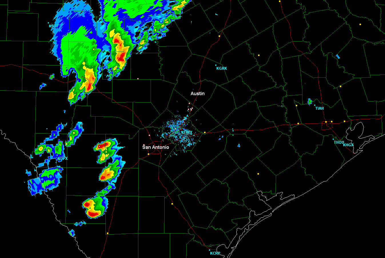
Above is the latest radar image from the San Antonio site. As you can see, the main line of storms we've been tracking all day is still well off to the Northwest of southcentral Texas. However, during the last hour, thunderstorms have rapidly begun to develop to the Southwest of San Antonio. These storms are moving Northeast at about 25 mph, with large hail indicated on radar.
The storms Southwest of San Antonio are likely to continue to increase in organization and intensity during the next few hours. Based on their present movement, they will threaten parts of the San Antonio Metro area around or shortly after sunset...more toward 8pm CDT. If they persist, they will then threaten the Kyle/Buda area and parts of the Austin Metro area later this evening, likely toward 10pm based on their present movement.

Large hail, damaging wind gusts and tornadoes will all be possible with the activity this evening. I would expect a new Tornado Watch to be issued East of the present watch, to include the Austin/San Antonio area, within 1-2 hours.
If you live across this region, remain alert this evening. Listen to local media or another trusted source for the latest updates and possible warnings. Make sure to identify your sheltering location ahead of time, that way you can get there quickly if a warning is issued for your area.
If you enjoy reading 'The Original Weather Blog', please be sure to "like" our facebook page!
No comments:
Post a Comment