
A severe thunderstorm threat, including a few tornadoes, exists across portions of the Deep South and southeastern U.S. today. A threat of mainly small hail and gusty winds extends Northward into the Tennessee and Ohio Valley regions as well.
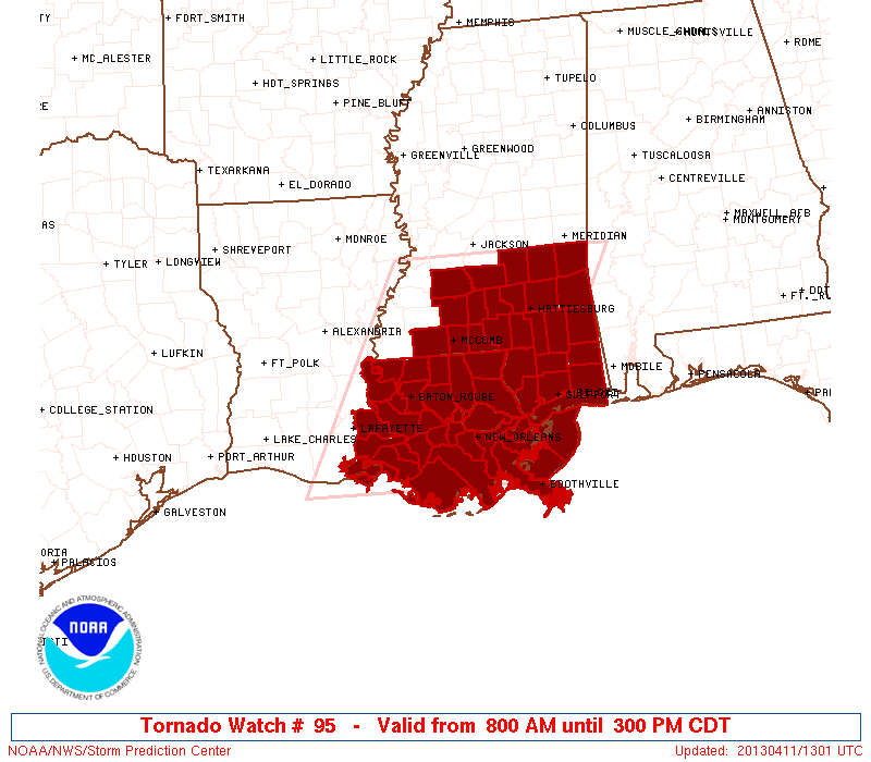
A Tornado Watch is already in effect for portions of Louisiana and Mississippi, valid until 3pm CDT:
Additional severe weather watches will follow today, so please be sure to pay attention to the weather if you live in the severe weather outlook areas.
For more information from 'The Original Weather Blog', including shorter, more frequent posts during rapidly changing weather events, please be sure to follow me on facebook and twitter:


Coming April, 2013: "The Tornado Chronicles" full website!
• Interactive tornado database back to 1950 (earlier years coming soon)
• Interactive radar with live warnings and street-level zoom
• Tornado safety, preparedness and education
• Daily tornado/severe weather outlook
• Photos, videos and more!
No comments:
Post a Comment