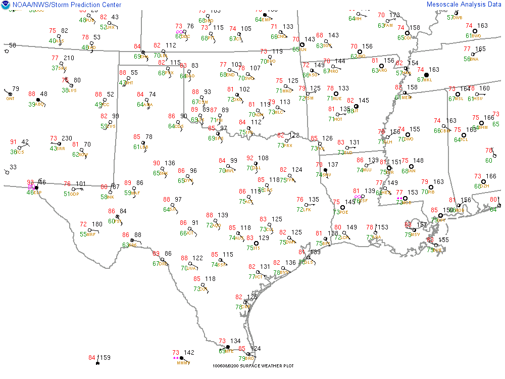
As you can see by examining the above surface map (taken at 9pm this evening, central time), dew point temperatures (show in green text) are in the mid to upper 70s across most of the area, with values near 80 degrees in far South Texas (that is downright tropical, folks)!
So why let all of this moisture go to waste? An upper level weather disturbance is forecast to move slowly across the state during the period Tuesday through Thursday. When this disturbance interacts with the copious amounts of moisture already present in the atmosphere, locally heavy rains are sure to take place. Take a look at the HPC (Hydrometeorological Prediction Center - fancy name for National Weather Service Headquarters) rainfall forecast for the period 7pm Monday through 7pm Wednesday:

So how exactly do we determine how much rain may fall in a given area? Weather balloons are released twice daily at certain locations across the country, in an effort to help us better understand (1). what is going on right now in the atmosphere and (2). what will be going on in later hours and days (the data is fed into computer models that derive forecasts, among other things). The stations nearest the Austin-San Antonio corridor that release balloons are Del Rio (DRT) and Corpus Christi (CRP). As the balloon rises up through the atmosphere, it transmits data back to the surface via a radio transmitter/receiver, which plots data such as temperature, dew point, humidity, wind speed and direction, etc., on a vertical map called a "sounding".
Below is an image of the sounding taken near Del Rio at 7am this morning:

Among all of the wiggly, wavy lines (which I'll go into in greater depth in a later post), there are some derived fields as well. If you look closely at the chart toward the bottom left section of the image, you'll see "PW=1.87 in." That stands for "Precipitable Water = 1.87 inches". Simply put, precipitable water is the amount of water in a given column of the atmosphere (in this case, the column was over Del Rio).
What this means is that if all of the water accumulating in the air column above Del Rio were to be precipitated (or rained) out, it would equal approximately 1.87 inches.
Anytime precipitable water is above 1 inch, that means the potential exists for locally heavy downpours that can accumulate rather quickly (i.e., an inch or more in an hour). As all Texans know, that can be good news in the middle of a hot, otherwise dry summer. So bring it on, we're ready for it!
No comments:
Post a Comment