As per the latest Oklahoma City radar image above, isolated thunderstorms are beginning to develop along the dryline from near Oklahoma City to northwest of Dallas/Ft. Worth.
Large hail, damaging winds and isolated tornadoes can be expected with any storm that is able to mature in this region. Individual storms will move East/Northeast once developed. The dryline itself will continue moving Eastward this afternoon and evening.
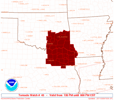
I would expect a Tornado Watch to be issued for most of this region soon.
***Update 1:45 PM CST:
A Tornado Watch has been issued, valid until 8pm CST:


No comments:
Post a Comment