
The above image shows severe weather reports (tornado reports highlighted in the text box on the left side of the image) from yesterday. As you can see, it was a very active day (as promised) across the Deep South.
It appears as though the region is in for another active weather day today, with severe storms already underway across portions of Alabama and Georgia at this time:
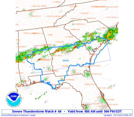
The SPC is forecasting severe storms to initiate across much of the same areas that were affected yesterday, then spread southward over time:

Initially, large hail and damaging winds will be the greatest threats, however as heating and instability increase this afternoon, isolated tornadoes will be possible once again.
Another threat today will be flash flooding. Since many of the same areas battered with heavy rain and thunderstorms repeatedly yesterday will be affected again today, the threat for flooding will be high in many areas.

The above image shows storm total rainfall (thus far) across much of Georgia. The darker red shaded areas indicate rainfall amounts of 3-4 inches, as estimated by the radar. Additional heavy rainfall can be expected in many of the same areas today, shifting Southward with time.
No comments:
Post a Comment