A strong (for this late in the season) cold front powered through Texas overnight, and has brought strong, gusty Northwest winds in its wake across the state today. Below is the latest surface weather map, valid 12:33 PM CST:


You can see temperatures in the upper 40s to lower 50s across much of the northwest half of the state, and in the 50s to lower 60s (and steady to slowly falling) elsewhere.
Gusty Northerly winds will continue through sunset in many areas, which will make it feel 10-20 degrees cooler outside than it really is.
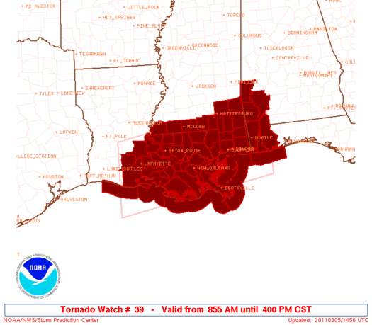
Ahead of the front over the deep South and Gulf Coastal region, severe weather is breaking out. A Tornado Watch is in effect for much of central and eastern Louisiana into adjacent portions of Mississippi and Alabama until 4pm CST:
The latest image from the New Orleans area radar below shows an intensifying line of thunderstorms advancing Eastward across the state:

The pink polygons on the image show where tornado warnings are currently in effect. No tornadoes have been confirmed as of yet, however radar suggests rotation strong enough to produce a tornado in these areas.
The threat of severe weather will spread East throughout the remainder of the afternoon and evening, along the coast and adjacent portions of Mississippi, Alabama and the Florida Panhandle:

No comments:
Post a Comment