
The National Hurricane Center (NHC) has upgraded "Invest 97" to Tropical Storm Irene. Based on recent Air Force Hurricane Hunter aircraft data, I am not surprised by this move, as pointed out in a recent post.
Below is a satellite image of Irene on a little wider view so that you can see her current position in relation to the U.S. (which is in the upper-left corner of the image):

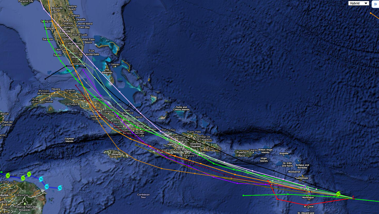
The official NHC forecast track is shown below:

Not surprisingly, the NHC forecast track is basically right down the middle of the latest computer forecast model guidance, which is shown on the composite image below:
I think they're being a bit conservative with the intensity forecast (which is typical - especially on the first advisory), but I am in agreement with the overall forecast track based on what I've seen so far.
If you live in Florida or the Southeast U.S., it would be a good idea to begin reviewing your Tropical Storm & Hurricane Preparedness Plan, and be ready to take action as more definite track and intensity forecasts are developed over the coming days.
I am preparing a more detailed post concerning the computer model forecasts and my thoughts on the potential track of Irene and plan to have that up tomorrow. This afternoon's hurricane hunter aircraft data will be fed into the computer forecast model cycle this evening, which should provide some good additional information on this subject.
If you enjoy reading 'The Original Weather Blog', please be sure to "like" our facebook page!
3 comments:
So if she remains on her current track what are her chances of hitting NE TN? If we are going to be affected what sort of weather problems do we have to look forward too? Thanks in advance!
Shamrock, thanks for the comment. It depends on how close the system hugs the coast after she moves North of Florida. At this time any impact rain-wise to you would be a week from today or tomorrow. We'll have to see how far West she tracks...
See my latest post for more details.
I read all your posts daily, Rob. You are THE weather forecaster for this house. Thanks for the information. A lot of people don't realize that the effects from a hurricane can come pretty far inland. I'll keep watching. Thanks!
Post a Comment