After receiving a full season's worth of snow in one day yesterday, the Seattle area is now socked in with a significant ice storm at this hour.
An Ice Storm Warning is in effect across much of the region, as shown by the purple shaded area on the image below:


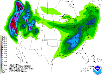
An Ice Storm Warning is in effect across much of the region, as shown by the purple shaded area on the image below:

Over 120,000 customers are currently without power across the Seattle metro area, and the governor has declared a state of emergency across the region.
Periods of freezing rain and snow will continue throughout the afternoon, with up to one-half inch of glazed ice accumulation possible. As you can imagine, the heavy glazing of ice over the existing snow cover is causing all sorts of problems. Needless to say, travel is highly discouraged (and downright dangerous).

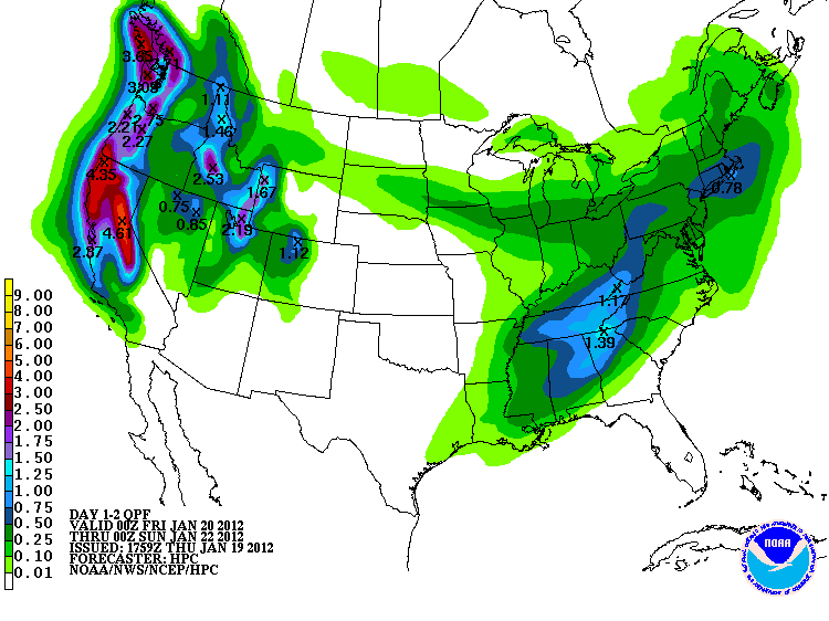
Precipitation will likely change back over to a mixture of snow and rain by early tonight, and then to all rain by Friday morning. Rain may be heavy at times Friday and Saturday, with widespread amounts of 3-5 inches likely:
Add melting snow into the equation, and there will be a significant threat of low-land and small stream flooding throughout the weekend.
If you enjoy reading 'The Original Weather Blog', please be sure to "like" our facebook page.
You can also follow us on twitter!
2 comments:
Rob,
I stumbled upon this blog last night--very impressive! It's a great place to get all of the day's weather highlights in one nutshell, and it'll definitely save me the time of combing through each NWS forecast office's discussion.
(Sidenote: I'm a weather enthusiast in Seattle, blogging about the weather at www.seattleweatherblog.com)
Meteorological spring is less than a week away--can't wait to to track some more storms...
Justin,
Thanks for the comment! I'm glad you're enjoying the blog; I'll have to check yours out!
Thanks again!
Rob
Post a Comment