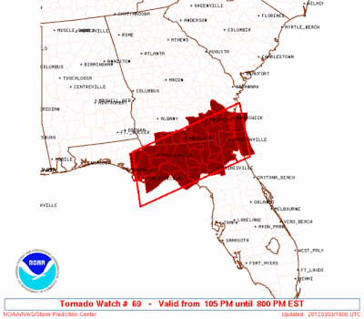
The cold front that was responsible, in part, for the incredible outbreak of severe weather yesterday continues to press to the Southeast today. The latest radar image above shows a line of strong to severe storms extending along the front from the Florida panhandle into southeast Georgia.
A Tornado Watch is currently in effect for the following areas along the line until 8pm EST:
If you live in northern Florida, or in extreme south Georgia along the Florida border, make sure that you stay weather-aware this afternoon and evening.
Further north across the remainder of southern Georgia and southeast South Carolina, heavy rain is now the primary concern.
If you enjoy reading 'The Original Weather Blog', please be sure to "like" our facebook page!


No comments:
Post a Comment