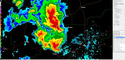
The above image was taken just a moment ago from the Billings, MT radar. You can see not one, but two supercells with hook echoes (strong radar indication of a possible tornado) just to the West and Northwest of Billings.
These storms are moving East/Northeast at 25 mph, with large hail also indicated.
So far, no on-ground tornado reports have been received with this activity, but these storms will remain dangerous for at least the next few hours. A Tornado Watch is in effect for much of the region until 1am MDT.

No comments:
Post a Comment