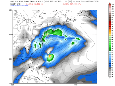
This will be an abbreviated weekly outlook compared to normal, and I apologize for not getting this posted yesterday as I customarily would (I was busy with the Northeast storm and some other things that were going on...)
In summary, we're trending toward a quieter time in the East and a more active time in parts of the West (and North) this week.
A ridge of high pressure will build into the East during the week, as a trough is gradually carved out West:
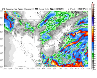
This will result in above normal precipitation across the Pacific Northwest, primarily from a storm that is expected to impact the region late Wednesday through Friday. The latest run of the GFS computer model is forecasting rainfall amounts in excess of 2 inches in many areas, as indicated by the red shaded regions on the image below:
This system will bring another round of snow to the Rockies at mid-week as well - almost exactly 1 week after the first significant event of the season in this region! Below is the latest GFS snowfall forecast centered on the Denver area. Most of the snow indicated on this image would fall late on Tuesday or on Wednesday (scale in inches at bottom of image):
Another popular U.S. computer forecast model, the NAM, is less aggressive in the Front Range and Foothills region (including Denver), but still forecasts accumulating snow on Wednesday:
In summary, we're trending toward a quieter time in the East and a more active time in parts of the West (and North) this week.
A ridge of high pressure will build into the East during the week, as a trough is gradually carved out West:
This will result in above normal precipitation across the Pacific Northwest, primarily from a storm that is expected to impact the region late Wednesday through Friday. The latest run of the GFS computer model is forecasting rainfall amounts in excess of 2 inches in many areas, as indicated by the red shaded regions on the image below:
This will also equate to locally heavy snows in the higher elevations of the Cascades by the end of the work week:
The Western trough will eject a piece of energy into the central Plains and Midwest by late Wednesday and into Thursday, which will give a shot of precipitation to that region as well. At this time it appears that it will be of little benefit to drought stricken Texas as a whole, as shown by the GFS model rainfall forecast image below (scale in inches shown on the right):
This system will bring another round of snow to the Rockies at mid-week as well - almost exactly 1 week after the first significant event of the season in this region! Below is the latest GFS snowfall forecast centered on the Denver area. Most of the snow indicated on this image would fall late on Tuesday or on Wednesday (scale in inches at bottom of image):
Another popular U.S. computer forecast model, the NAM, is less aggressive in the Front Range and Foothills region (including Denver), but still forecasts accumulating snow on Wednesday:
I think accumulating snow is a safe bet for the region at mid-week, the main question at this point is just how much. Stay tuned for updates on that on Monday, as we ought to have a much better idea.
If you enjoy reading 'The Original Weather Blog', please be sure to "like" our facebook page!


