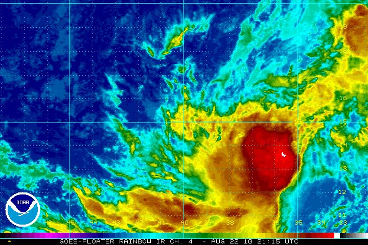
As of the 4pm Central Time update...the National Hurricane Center has upgraded Tropical Depression 6 to Tropical Storm Danielle. This is right in line with what we had anticipated in earlier posts. The thunderstorm activity has now encircled the center of the system, and maximum sustained winds are estimated at 40 mph.
At 4pm...the center of Danielle was located 725 miles West of the southernmost Cape Verde Islands, and moving Northwest at 12 mph.
The question now, of course, is what will happen from this point forward. In general, Danielle will remain a "fish storm", affecting the open Atlantic and not threatening any major land masses for the foreseeable future.

Computer forecast models generally move the system West/Northwest, then more toward the Northwest by mid-week. The real question at this point concerns the intensification of the system. Most models still intensify Danielle to a hurricane by late Tuesday or Wednesday, but after that point there may be some atmospheric conditions come into play that would actually cease intensification or even weaken the system. Fortunately it will be out in the open waters still at that time, which gives us plenty of time to monitor the system and update forecasts.
No comments:
Post a Comment