The above satellite picture was taken about 45 minutes ago, and shows the remnants of what was Tropical Depression 5 over the southcentral Gulf Coast. It is currently drifting slowly Southward, and will emerge back out over the warm Gulf waters on Monday.
The $64,000 question is...what will happen once the system moves back out over the Gulf? Middle & upper-level winds will be favorable for development and that, coupled with the fact that the waters over the Gulf are very warm further suggests that additional development can be expected.
One of the major factors will be how far out over the water will the center of the system progress? If a majority of the system straddles the coastline, that constant interaction with land would have a negative impact on organization/intensification. If, however, the bulk of the system emerges back out over the warm Gulf waters, further development is likely.
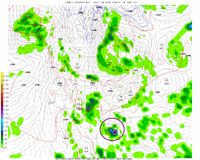
Here is what one of the computer forecast model solutions is showing this morning, as far as the eventual track of the system is concerned:
Valid 7am CDT Monday
Valid 7am CDT Tuesday

Valid 7am CDT Wednesday
As you can see, this particular forecast model is calling for the system to track West along the coast and eventually move back inland over Louisiana on Wednesday morning.
Residents along the Gulf Coast should stay alert and monitor the development and progress of this system over the next few days.


No comments:
Post a Comment