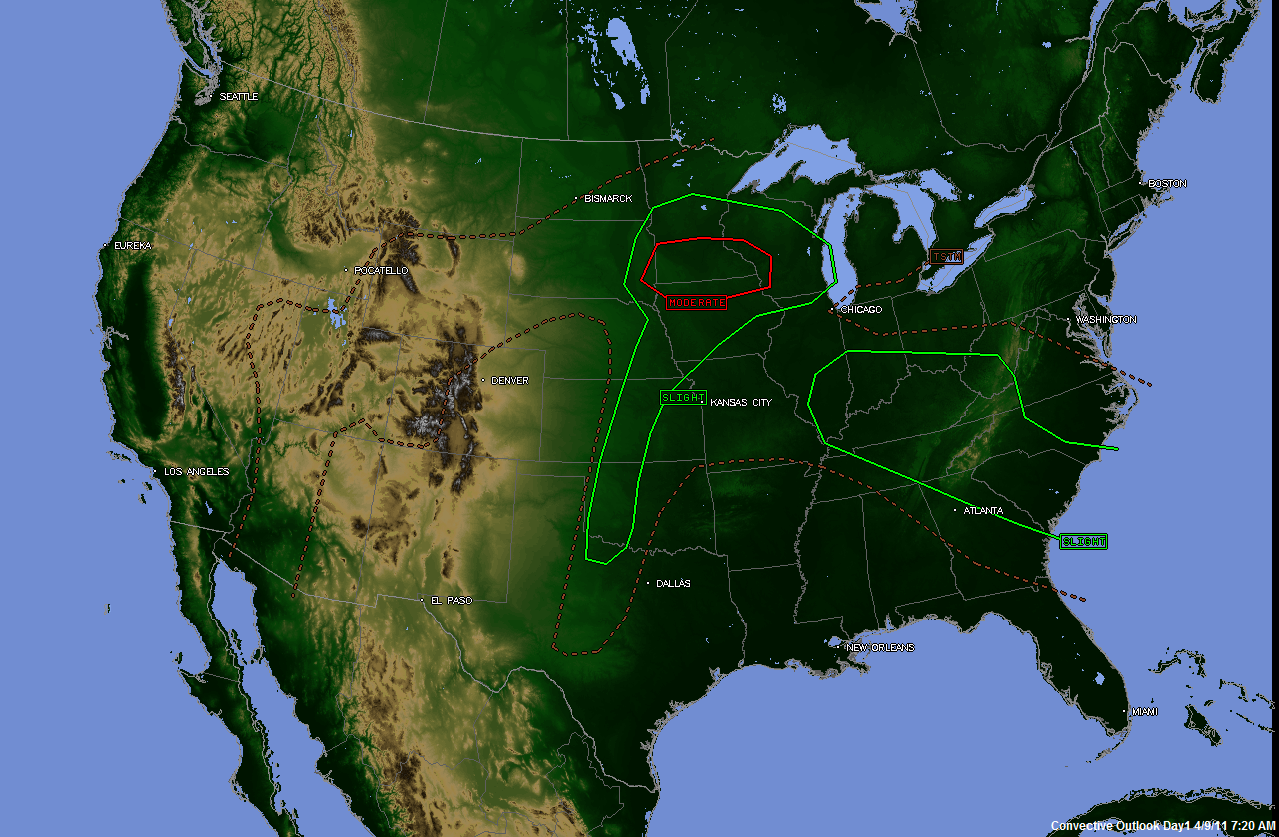
The above image shows the latest severe weather outlook for today and tonight from the SPC. Areas outlined in green can expect isolated to scattered severe storms, while the area in red can expect a more widespread threat of severe weather.
Thunderstorms have already begun to organize this morning across portions of southern Indiana and northwest Kentucky, where a Severe Thunderstorm Watch is currently in effect until 1pm CDT:

This activity is expected to continue moving/developing toward the East/Southeast during the day today, traversing the severe weather outlook area across the Tennessee and Ohio Valleys into the Appalachians.
Focusing on the enhanced severe weather threat for later today, below are the SPC forecasts of Tornado and Large Hail probability, respectively:


When viewing the probability maps, it's less important to focus on the "percent chance" element than to focus on the areas where the enhanced risk is forecast. With that having been said, if you live in southwest and southcentral Minnesota, northwest Iowa or adjacent portions of extreme southeast South Dakota or northeast Nebraska, you should stay alert later today for severe storms that could produce large hail, damaging winds and tornadoes.
Isolated to scattered severe storms are forecast to develop by late this afternoon or early this evening near the intersection of a surface low pressure center, dryline and warm front across extreme southeast South Dakota, extreme northeast Nebraska, southwest Minnesota and/or northwest Iowa. This activity will move and develop Eastward into the remainder of the severe weather outlook areas during the evening and overnight hours.

Any storm that interacts with the warm front along and either side of the Iowa/Minnesota borders will have an enhanced threat of producing a tornado. Very large hail (in excess of 2 inches in diameter) will also be possible with this activity.
This enhanced threat of severe weather will include the Minneapolis/St. Paul area late this afternoon or more likely this evening.
Further South along the dryline, isolated severe storms are possible across remaining portions of the severe weather outlook area from central Kansas into western Oklahoma and perhaps extreme northwest Texas. It will be harder for storms to form in these areas (particularly the Oklahoma and Texas portions) due to a strong capping inversion that is in place across the region.
Any storm that is able to form in this latter area will be capable of producing large hail, damaging winds and an isolated tornado.
2 comments:
Rob - we live in the Hill Country and (as you are aware) desperately need rain? Think you can push some of that weather a little further south??? ;)
I apologize, I only just now saw your comment (I'm a bit behind, I'm afraid!).
I'm with you 100%. We desparately need rain. I hate to say it, but our best bet may be a tropical system that moves on to the coast later this summer. That may be our best chance at widespread, meaningful rain unless a major pattern change happens...
Post a Comment