
Above is the latest severe weather outlook from the SPC in Norman. In general, severe thunderstorms are forecast this afternoon & evening within the yellow shaded areas.
The greatest risk of severe storms, including very large hail, damaging winds and tornadoes, will be within the red and black hatched areas on the image below:

This enhanced risk of severe weather includes the Kansas City, Springfield, Chanute, Tulsa, Ft. Smith and Dallas areas.
Early this morning, a weak Pacific cool front stretched across southcentral Nebraska into southwest Kansas and the panhandles. A dryline extended from an area of low pressure over southwest Kansas, into western Oklahoma (see image below):

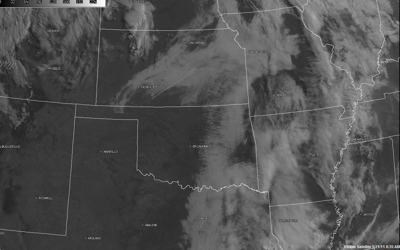
Unlike the past few days, there are no thunderstorms or areas of rain and widespread clouds ongoing along and ahead of these boundaries this morning. As you can see by the visible satellite image below, skies are largely clear along and ahead of the dryline in Oklahoma & Kansas, as well as ahead of much of the front in Kansas and Nebraska:
Ample sunshine and strengthening Southerly winds will result in a very unstable airmass ahead of the boundaries by afternoon. By mid to late afternoon, the boundaries are expected to extend along the western edge of the severe weather outlook area from the first image in this post.
Thunderstorms are forecast to initiate from southcentral or southeast Nebraska into central portions of Kansas and Oklahoma by mid to late afternoon. This activity will move/develop East/Northeast into adjacent portions of eastern Kansas, eastern Oklahoma, western Missouri & western Arkansas into the late afternoon & evening hours. Large hail, damaging winds and a few tornadoes will all be possible with this activity.
Due to the strength of the instability expected this afternoon, and with winds increasing at all levels of the atmosphere in a manner favorable for severe weather, at least a few of the severe storms are likely to become particularly organized with an enhanced threat of severe weather. This is especially possible within the red and black hatched areas on the image below:

Hazards with the more mature and organized severe storms in this area would include very large hail, damaging winds and tornadoes. This includes the Kansas City, Springfield, Joplin, Tulsa, Ft. Smith and possibly the Dallas area (or just to the East). If you live in or near these areas, please pay particular attention to the weather this afternoon and evening.
In Texas, thunderstorm development is likely to occur southward along the dryline in northcentral Texas by late this afternoon or early this evening. Additional development will take place further southward along the dryline into central Texas by early evening. Some of these storms will also become severe, with large hail the primary threat. Damaging winds and an isolated tornado are also possible with any more organized storms that are able to form, particularly over northeast Texas.
Outflow boundaries were also left behind by thunderstorm activity in central and east-central Texas overnight. Thunderstorms may also form along these leftover boundaries as well as ahead of the dryline in central and southcentral Texas late this afternoon or this evening.
I believe the severe weather risk area as outlined in the 1st image should be extended further southwest in Texas along the I-35 corridor, to include the Austin & San Antonio areas. I would expect to see that change made to the mid-morning update from the SPC, based on the surface and model data that is currently coming in. If you live in the Austin/San Antonio areas, please also keep an eye out for possible severe weather late this afternoon or evening.
No comments:
Post a Comment