
The above mosaic radar image shows clusters of strong thunderstorms developing well to the North of a surface cold front over northern Texas and southern Oklahoma. As pieces of energy in the middle and upper levels of the atmosphere move out over this region later this afternoon and into this evening, the activity is likely to intensify further, with large hail and gusty winds possible. This activity will move and/or develop East/Northeastward into southern and central Arkansas as the afternoon & evening progress, again with a threat of mainly large hail in a few of the storms.
Further South, the actual cold front at the surface currently stretches from northeast Texas into the Austin/San Antonio corridor, and on back Westward toward San Angelo. The front is nearly stationary at this time:
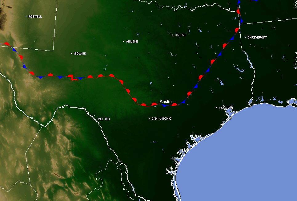
Most of the upper-level energy is currently passing well to the North of the front across north Texas and Oklahoma, which has tended to limit the development of any activity along the front across southcentral Texas thus far.
Any thunderstorm development in the South, including the Austin/San Antonio area, will be rather isolated this afternoon and evening. If a storm does manage to develop, it is likely to become strong to severe quickly, producing damaging winds and large hail. An isolated tornado also cannot be ruled out, due to the change in wind direction with height near the frontal boundary.
Folks across the region should remain alert this afternoon & evening. Listen to NOAA Weather Radio or local media for later updates, watches and possible warnings.
If you enjoy reading 'The Original Weather Blog', please be sure to "like" our facebook page!
No comments:
Post a Comment