
The above image was just taken from the New Orleans area radar. A line of strong to severe storms extends from near Morgan City to Edgard, and then on toward the Northeast up to the Picayune area in far southern Mississippi. The northern end of the line is the strongest at this time, with a Tornado Warning in effect within the lavender polygons.
The southern portion of the line, which will affect the New Orleans area, has slown its forward speed over the last 30-45 minutes, and based on present movement toward the East at 20-25 mph, it will reach the New Orleans area between 1:30 and 2pm CST.
Additional, new, activity may develop over the immediate New Orleans area before the main line arrives from the West, so folks across the area need to remain alert.
The southern portion of the line may intensify as it approaches more unstable air near the New Orleans area. Strong, gusty winds and hail up to 1 inch in diameter are the greatest threats with this activity, however brief tornado spin-ups are also possible along the leading edge of the line.
Very heavy rainfall and frequent lightning can also be expected. Widespread rainfall amounts of 2-3 inches with locally higher amounts are possible, which could lead to flash flooding.
Rain will continue well into the afternoon and early evening hours across New Orleans even after the initial thunderstorm line passes. A large shield of rain currently extends back to the West as far as the Texas border:

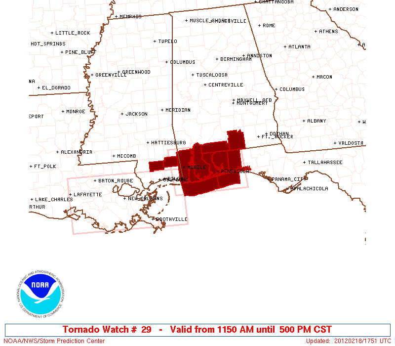
Tornado Watches remain in effect until 3pm and 5pm CST, respectively across the region:

If you enjoy reading 'The Original Weather Blog', please be sure to "like" our facebook page!
No comments:
Post a Comment