The following Tornado (red) and Severe Thunderstorm (blue) watches are currently in effect:
You can visit this page on the SPC website for specific details on the watch(es) for your area.
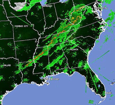
A band of strong to severe thunderstorms currently extends from southeastern Kentucky across the middle third of Tennessee, and are developing Southwest across northern Mississippi and northeast Louisiana:
At this time, the highest threat of severe weather, including damaging winds and tornadoes, is located within an area extending from northeast Mississippi across middle Tennessee and into southeastern Kentucky, generally within the area outlined in solid red on the image below (along and to the East of the thunderstorm line within that region):
Folks all across the severe weather watch areas, and particularly along and ahead of the line of storms from northern Mississippi (and northwest Alabama) into middle Tennessee and southeast Kentucky should remain on a high state of alert this afternoon and evening. Listen to local media or another trusted source for the latest weather information and possible warnings. Take a few moments to review severe weather safety and preparedness tips, that way you're ready to take action when threatening weather approaches your area. This includes identifying the best sheltering option and having a plan in place to get there quickly.
If you enjoy reading 'The Original Weather Blog', please be sure to "like" our facebook page!


No comments:
Post a Comment