Computer forecast models today continue to point to an area from northcentral and northeast Colorado into southwest through east-central Nebraska, northwest Kansas and eventually western and northern Iowa for the axis of heaviest snowfall this weekend.
Here are the latest projections from the HPC, which indicate the likelihood of 4, 8 or 12 inches or more of snow, respectively. The first series is for Friday:


Here are the latest projections from the HPC, which indicate the likelihood of 4, 8 or 12 inches or more of snow, respectively. The first series is for Friday:


...and the second series is for Saturday:

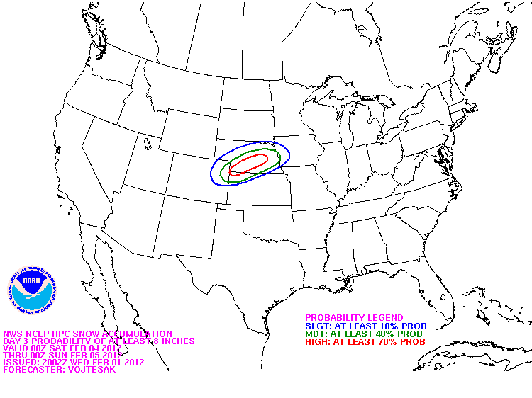

On each image, there is a slight chance (10-30%) of the indicated value within the blue outlined area, a moderate chance (40-60%) within the green outlined area, and a high chance (70%+) within the red outlined areas.
We'll be able to become much more specific as to the likely magnitude of this event tomorrow, so stay tuned for updates!
If you enjoy reading 'The Original Weather Blog', please be sure to "like" our facebook page.
No comments:
Post a Comment