So far, things seem to be progressing about like we expected in the updates late yesterday afternoon.
Light precipitation is beginning to break out in swath extending from the four corners region, Southeastward across New Mexico and into west-central and southwest Texas:

Snow will increase across east-central New Mexico and into the Texas Panhandle and west-central Texas during the day, with accumulations of 1-3 inches likely, especially within the lighter blue area on the image below:

Locally heavy amounts up to 4 inches are possible, especially over the southern Texas panhandle and into the northern portions of west-central Texas (generally in an area bounded by a line from Lubbock to Childress to Amarillo to near Clovis and back to Lubbock).
To the South of this area of snow, a mixture of freezing rain and sleet will be the primary concern today, with some light ice accumulation possible within the blue shaded areas on this image through this evening:

A mixture of light rain, light freezing rain, light sleet and/or light snow may reach into portions of the Texas Hill Country and toward the I-35 corridor this morning before the temperature rises above the mid to upper 30s. Significant accumulations are not expected with this activity.
By tonight, the wintry precipitation threat will shift into the Oklahoma / Missouri / Arkansas region. The latest model trends confirm the "middle of the road" approach that I suggested late yesterday afternoon, with widespread amounts of 1-3 inches likely in a fairly large area from east-central and northeast Oklahoma into adjacent portions of Missouri and Arkansas (as noted by the grey shaded areas on the image below:

Localized amounts around 4 inches will be possible, especially within the yellow outlined area on the above image.
An area of freezing rain and/or sleet is also expected to the South of this precipitation, across southeast Oklahoma and into central and southern Arkansas. The greatest threat of ice that could accumulate lightly would be within the blue shaded areas on the images below, valid at 12 Noon CST Monday:
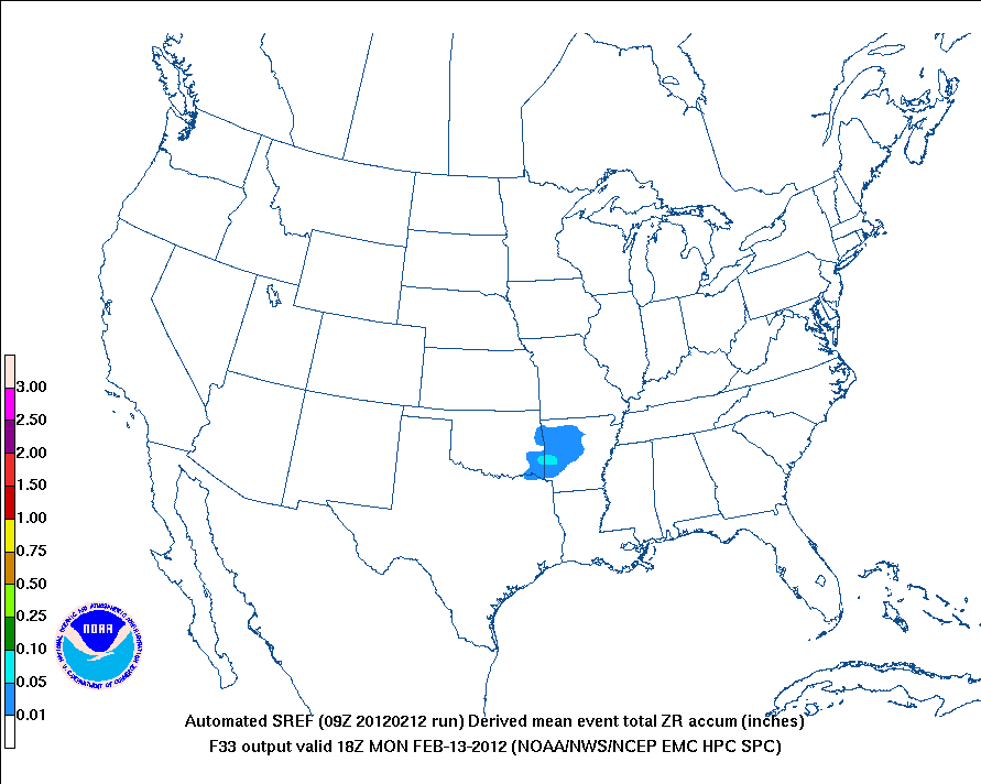
...and 4pm CST Monday:

A variety of winter weather advisories are in effect across the region:

The pink shaded area over northwest Arkansas corresponds with a Winter Storm Warning that has been issued due to a concern over both snow and/or ice accumulation later tonight and Monday. Otherwise, Winter Weather Advisories cover most of the remainder of the region discussed, as indicated by the tan shaded areas on the image.
If you have travel plans across this region today, tonight or Monday, be sure to allow extra travel time and check on weather conditions before you head out.
Watch for an updated post this afternoon which will reflect the latest trends being observed through that time...
If you enjoy reading 'The Original Weather Blog', please be sure to "like" our facebook page!
No comments:
Post a Comment